Catalog Archive
Auction 170, Lot 684

"Chart of the New Northern Archipelago; Discover'd by the Russians, in the Seas of Kamtschatka & Anadir", Conder, Thomas

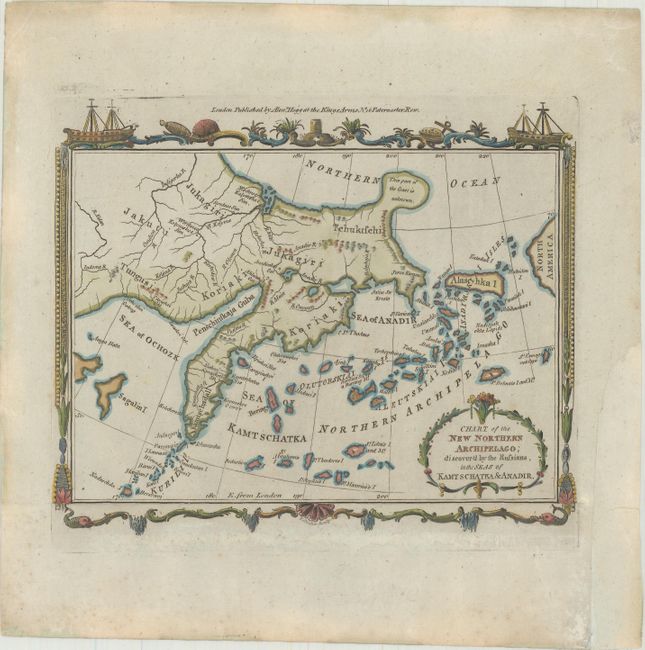
Subject: North Pacific Ocean

Period: 1782 (circa)

Publication: Millar's New and Universal System of Geography

Color: Hand Color

Size:
7.8 x 6.3 inches
19.8 x 16 cm
Download High Resolution Image
(or just click on image to launch the Zoom viewer)

This small and striking map covers the Russian Far East and the Aleutian Islands and centers on Kamchatka Peninsula. It has been trimmed and excerpted from a sheet featuring five maps. Small individual islands are named, and rivers are identified throughout. A note on the northernmost knob of land reads, "This part of the Coast is unknown." There is a decorative title cartouche at bottom right. The map is surrounded by a decorative border. Third state, with Alexander Hogg's publisher's imprint along the top of the sheet.

References: McCorkle (18th C. Geography Books) #281-8.

Condition: B+

A crisp impression. The bottom border of the original sheet has been attached to the map just below neatline with archival tissue. A chip in the right margin has been replaced with old paper.

Estimate: $100 - $130

Sold for: $50

Closed on 11/14/2018

Archived