Catalog Archive
Auction 170, Lot 679

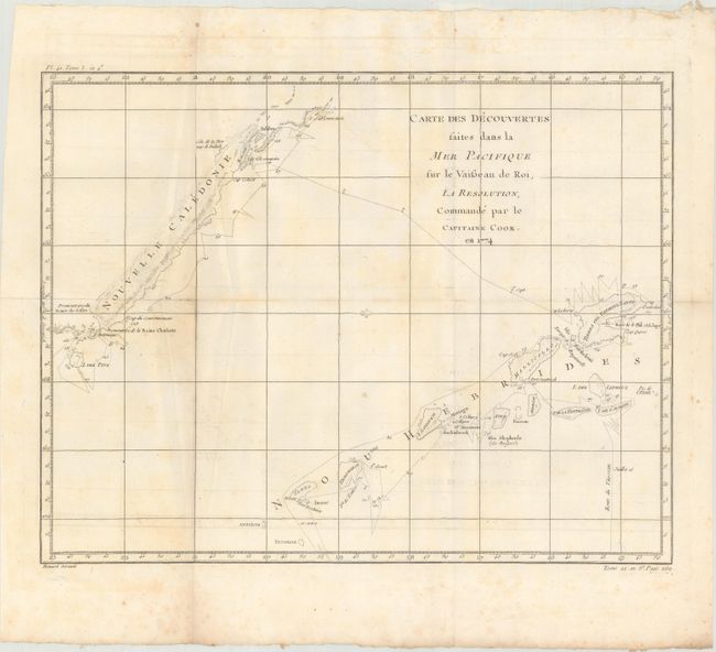
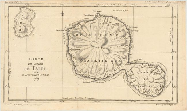
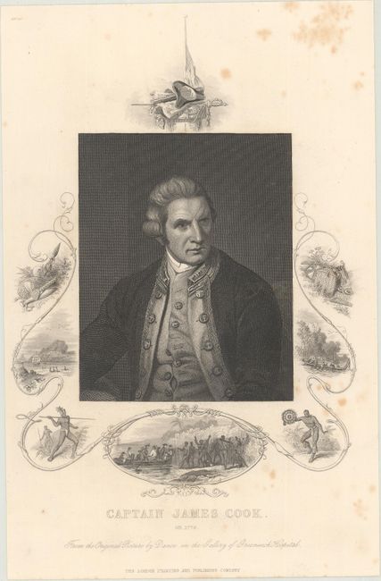
"[Lot of 4] Carte de la Partie Septentrionale de la Mer du Sud... [and] Carte des Decouvertes Faites dans la Mer Pacifique... [and] Carte de l'Isle de Taiti, par le Lieutenant J. Cook 1769 [and] Captain James Cook...", Cook, James (Capt.)

Subject: Pacific Ocean, Pacific Islands

Period: 1780-1850 (circa)

Publication:

Color: Black & White

Size:
See Description
Download High Resolution Image
(or just click on image to launch the Zoom viewer)

Captain James Cook (1728-1779) is best known for his three voyages to the Pacific (1768-71; 1772-75; and 1776-79). His discoveries radically changed the western understanding of the world in the late 18th century. He was the first to circumnavigate and chart New Zealand and provided the earliest European accounts of exploration along the eastern coast of Australia and the Hawaiian Islands. On February 14th, 1779, he was killed on Hawaii after attempting to kidnap the chief of the island.

Many contemporary accounts of Cook’s voyages, including charts and engravings, appeared in the late 18th century. The first official account of Cook’s first voyage was published in 1773 by John Hawkesworth in Volumes II and III of An Account of the Voyages Undertaken by the Order of His Present Majesty for Making Discoveries in the Southern Hemisphere... William Strahan and Thomas Cadell published the first official accounts of the second and third voyages in 1777 and 1784. Accounts of his exploration were subsequently translated into French, German, and Dutch.

A. Carte de la Partie Septentrionale de la Mer du Sud, Comprise Entre la Californie, les Isles Sandwich, le Japon et le Detrt. de Behring..., by Jacques Nicolas Bellin, circa 1782 (14.5 x 9.2"). This fine map is based on the Henry Roberts/Cook chart with the addition of China, Japan, and the Sandwich Islands. It details the adjacent coastal areas of Russian Asia from the Bering Strait and the Kamchatka Peninsula down to Japan, Korea, and China, and across to the west coast of North America down to below the Baja Peninsula. The interior of the Northwest is completely blank, but details are beginning to emerge along the coastal areas as the maps names R. De Cook, Port De Norton, the B. De Bristol, Ounalachka, and more. Shows the tracks of Capt. Cook's ships, the Resolution and the Discovery, during Cook's third voyage to the Pacific between 1778 and 1789. Cook traveled from the Sandwich Islands to Nootka and the southern coast of Alaska, where he surveyed Prince William Sound and the Aleutian Islands. He then continued northward through the Bering Strait to the Arctic above the 70th parallel before weather and ice forced his return to the Sandwich Islands. The map features lakes, rivers, mountains and other geographical features. Finely engraved by Dupuis. An uncommon Cook map. Condition: Issued folding on watermarked paper with a few spots and light offsetting at top. (B+)

B. Carte des Decouvertes Faites dans la Mer Pacifique sur le Vaisseau de Roi, la Resolution, Commande par le Capitaine Cook. En 1774, by Jacques Nicolas Bellin, circa 1780 (18.4 x 14.2"). A delicately engraved exploration chart that details the second voyage (1774) of Captain Cook in the Pacific. The track of the HMS Resolution near New Caledonia and New Hebrides, situated well off the east coast of Australia, is shown with a daily timeline. Hazards noted along the ship's track include shoals and rocks. Condition: Issued folding on watermarked paper with light scattered foxing and a bit of offsetting at bottom. (B+)

C. Carte de l'Isle de Taiti, par le Lieutenant J. Cook 1769, by Jacques Nicolas Bellin, from Histoire des Voyages, circa 1780 (16.0 x 9.3"). This chart of the islands of Tahiti is one of the earliest depicting the island and is a result of Cook's first voyage. Fully engraved to show the island's unique mountainous topography and the rivers which radiate from the centrally located mountain or volcano. A petition by the Royal Society to King George III requesting a scientific expedition to the Pacific to study and observe the 1769 transit of Venus across the sun from the island of Tahiti resulted in Cook's first expedition. In addition to the approved scientific voyage, the Admiralty embarked on a confidential mission to search the south Pacific for signs of the postulated continent Terra Australis Incognita. Engraved by Benard. Condition: Issued folding on watermarked paper. (A)

D. Captain James Cook. Ob. 1779. From the Original Picture by Dance in the Gallery of Greenwich Hospital, by London Printing & Publishing, circa 1850 (6.3 x 8.8"). A crisp portrait of Captain Cook surrounded in an elaborate border featuring various native scenes. Condition: Light scattered foxing mostly in the blank margins. (B+)

References:

Condition:

See description above.

Estimate: $220 - $250

Sold for: $150

Closed on 11/14/2018

Archived