Catalog Archive
Auction 170, Lot 607

"Tabula Itineris Decies Mille Graecorum sub Cyro Contra Fratrem suum Artaxerxem, Regem Persarum...", Duval, Pierre

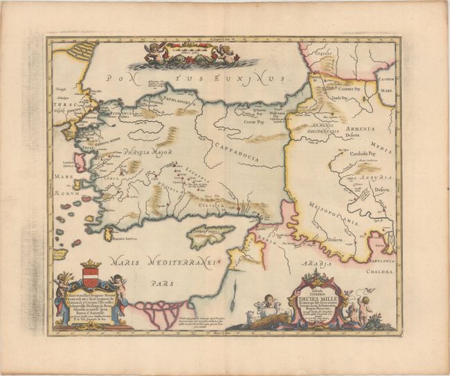
Subject: Middle East

Period: 1741 (published)

Publication: Description Exacte de l'Univers, ou l'Ancienne Geographie Sacree et Profane

Color: Hand Color

Size:
19.2 x 16.1 inches
48.8 x 40.9 cm
Download High Resolution Image
(or just click on image to launch the Zoom viewer)

This historical map illustrates the region involved in the conquest of Cyrus the Great (558-528 BC), the founder of the Persian Empire under the Achaemenid dynasty. It covers all of Asia Minor through to Armenia and Babylon. Three superb cartouches featuring putti adorn the map, which was compiled and drawn by Pierre Duval for Jansson's historical atlas. Blank verso, published in Pieter de Hondt's Description Exacte de l'Univers, ou l'Ancienne Geographie Sacree et Profane, a French edition of Georgius Hornius' Accuratissima Orbis Antiqui Delineatio, which included maps from Johannes Jansson's historical atlas and Abraham Ortelius' Parergon.

References: Van der Krogt (Vol. I) #8110H:1.

Condition: A

A sharp impression on a sheet with wide margins, a crease at left, a small paper flaw south of Cyprus, and printer's ink residue in the blank margins.

Estimate: $275 - $350

Unsold

Closed on 11/14/2018

Archived