Catalog Archive
Auction 170, Lot 489

Battle of Waterloo

"Afteekening der Veldslagen van Lignij, Quatre Bras en la Belle Alliance, Tegen Napoleon Bonaparte, op 16, 17 en 18 Junij 1815",

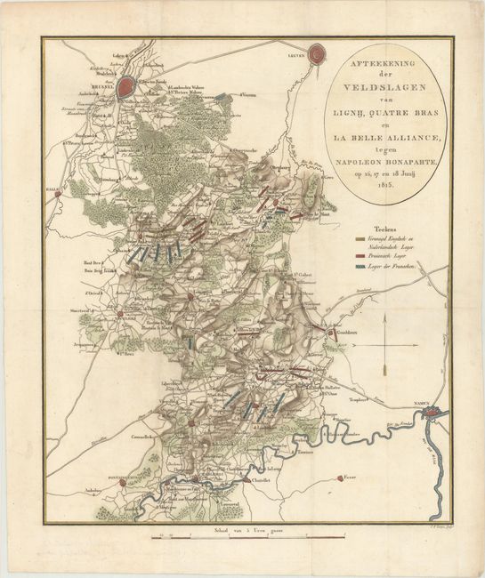
Subject: Central Belgium

Period: 1816 (circa)

Publication:

Color: Hand Color

Size:
11.7 x 13.9 inches
29.7 x 35.3 cm
Download High Resolution Image
(or just click on image to launch the Zoom viewer)

This map depicts the Battle of Waterloo, which was fought on 18 June 1815, and the campaign leading up to it. The map shows the region between Brussels, Leuven and Namur, with excellent detail of the topography, roads, and villages in the region. The locations of the various troops are identified with a color-coded chart, with the English and Dutch combined forces in yellow, the Prussian troops in red, and the French troops in blue. Engraved by Johannes Fredericus Lange.

References:

Condition: A

Issued folding, now flattened, with very minor soiling and a couple of minute worm holes only visible when held to light.

Estimate: $160 - $190

Sold for: $80

Closed on 11/14/2018

Archived