Catalog Archive
Auction 170, Lot 454

"Pascaarte van Engelant van t' Voorlandt tot aen Blakeney waer in te Sien is de Mont vande Teemse", Goos, Pieter

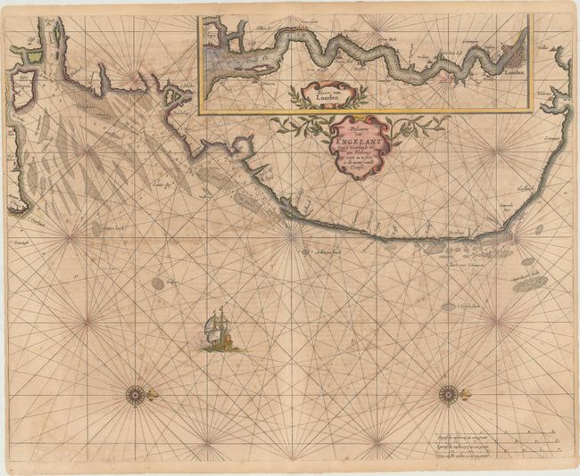
Subject: Southeastern England, London, Thames River

Period: 1666 (circa)

Publication: De Zee-Atlas Oste Water-Weereld...

Color: Hand Color

Size:
21.4 x 16.9 inches
54.4 x 42.9 cm
Download High Resolution Image
(or just click on image to launch the Zoom viewer)

This uncommon sea chart spans the southeastern coast of England from the mouth of the Thames to Norfolk. It is inset with a map continuing the course of the Thames to London. Both the main and inset charts feature decorative title cartouches, rhumb lines, anchorages, and soundings. There are two fleur-de-lis capped compass roses and a sailing ship in the North Sea.

Pieter Goos was one of Amsterdam’s most prominent publishers of nautical charts. The reputation of his firm was matched only by that of the publishing houses of Blaeu and van Keulen and his maritime atlas of the world was one of the most complete sea atlases published prior to the appearance of Van Keulen’s Zee-Fakkel in the 1680s. The Zee-Atlas was often published with Blaeu's Atlas Maior, the most lavish and expensive cartographic publication of the period.

References: Shirley (BL Atlases) M.GOOS-2a.

Condition: B

There is moderate toning and offsetting, some light scattered foxing, and some short edge tears along the bottom margin that have been closed on verso with tape.

Estimate: $750 - $900

Unsold

Closed on 11/14/2018

Archived