Catalog Archive
Auction 170, Lot 395

"Carte de la Dominique Prise par les Francois le 7 Septembre 1778. Avec le Plan du Debarquement, et de l'Attaque des Forts et Batteries par les Troupes et les Fregates de sa Majeste...", Buache, Philip
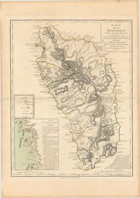
Subject: Dominica

Period: 1778 (dated)

Publication:

Color: Hand Color

Size:
18.6 x 24 inches
47.2 x 61 cm
Download High Resolution Image
(or just click on image to launch the Zoom viewer)

This large, detailed map of the island of Dominica was produced shortly after the French had taken the island from the British during the American Revolutionary War. The map is based on two British maps: John Byres' 1766 map that was the first to chart the interior of the island, and Thomas Jefferys' 1768 map that was compiled from the first surveys conducted from 1765 to 1773. It shows the ten parishes, towns and villages, forts, churches, roads, rivers, mountains and Carib Indian lands. The coastal information includes soundings and navigational hazards. A large inset at bottom shows the Invasion of Dominica at Charlottesville. The British line of fortifications that ran from just north of Roseau to Fort Cachacrou is portrayed in great detail. A small inset map of the Lesser Antilles shows the relative position of Dominica.

References: Sellers & Van Ee #2041; Tooley (MCC-62) #9.

Condition: A

Nice impression and original color on watermarked paper with wide margins and a hint of toning along centerfold and edges of the sheet.

Estimate: $375 - $450

Sold for: $190

Closed on 11/14/2018

Archived