Catalog Archive
Auction 170, Lot 360

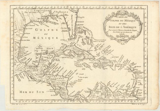
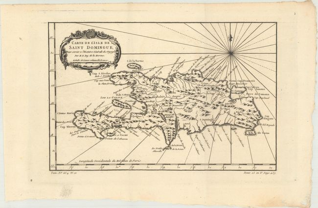
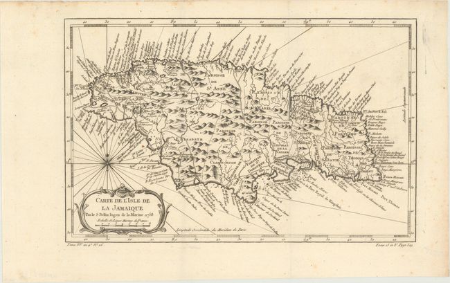
"[Lot of 3] Carte du Golphe du Mexique et des Isles de l'Amerique...[and] Carte de l'Isle de Saint Domingue... [and] Carte de l'Isle de la Jamaique", Bellin, Jacques Nicolas

Subject: Gulf of Mexico & Caribbean, Hispaniola, Jamaica

Period: 1754-58 (circa)

Publication: Prevost's Histoire Generale des Voyages

Color: Black & White

Size:
See Description
Download High Resolution Image
(or just click on image to launch the Zoom viewer)

A. Carte du Golphe du Mexique et des Isles de l'Amerique pour Servir a l'Histoire Generale des Voyages, dated 1754 (15.1 x 10.8"). Attractive map of the islands of the Caribbean along with the parts of the United States and Mexico that border the Gulf of Mexico, Central America, and the northern coastline of South America. The routes of several explorers are shown, including Cortez, Ponce de Leon, and Hernandez de Cordova, along with many coastal place names. A delicately engraved rococo-style title cartouche fills the upper right.

B. Carte de l'Isle de Saint Domingue..., (11.4 x 7.5"). This copper-engraved map of Hispaniola names several capes, ports, and bays running along the coast of the island, as well as identifying numerous towns and rivers inland. A compass rose capped with a fleur-de-lis radiates rhumb lines and a title cartouche draped in garlands adorns the upper left corner.

C. Carte de l'Isle de la Jamaique, dated 1758 (12.1 x 7.8"). Strongly engraved map describes this island of the Greater Antilles. Divided by parishes, the map shows remarkable detail with scores of place names along the coast plus mountains, personal estates, watersheds, and other details in the interior.

References:

Condition: A

Dark impressions on clean sheets with a bit of faint foxing mostly in the blank margins. Issued folding.

Estimate: $250 - $325

Sold for: $180

Closed on 11/14/2018

Archived