Catalog Archive
Auction 170, Lot 322

Attractive Chart of the Chesapeake Bay

"(C No. 2) Preliminary Chart of Part of the Sea Coast of Virginia and Entrance to Chesapeake Bay...", U.S. Coast Survey

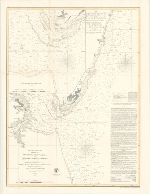
Subject: Eastern Virginia, Chesapeake Bay

Period: 1855 (dated)

Publication:

Color: Hand Color

Size:
20.9 x 27.8 inches
53.1 x 70.6 cm
Download High Resolution Image
(or just click on image to launch the Zoom viewer)

The Office of Coast Survey is the oldest U.S. scientific organization, dating from 1807 when Congress directed that a "survey of the coast" be carried out. By 1836, it was called the U.S. Coast Survey and in 1878, the name was changed to the U.S. Coast and Geodetic Survey. Today the Office of Coast Survey is a division of the National Oceanic and Atmospheric Administration NOAA.

The survey teams, composed of civilians as well as Army and Naval officers, charted the nation's waterways and produced a wide array of reports, survey charts, hydrographic studies of tides and currents, astronomical studies and observations, and coastal pilots. These charts are an important record of the changing nature of the nation's coastlines. In additional to coastal charts, the U.S. Coast and Geodetic Survey produced land sketches, Civil War battle maps, and the early aeronautical charts.

This striking Coast Survey chart depicts the entrance to the Chesapeake Bay between Cape Henry and Cape Charles and extends to False Cape in the south and Metompkin in the north. The intricate details include scores of soundings, extensive sailing directions, bottom types, currents, and other navigational information. Includes a large inset map of the entrance to the bay. Drawn by Williams, Shoepf, and Balbach and engraved by Yeager, Barnard, Petersen, and Bartle.

References:

Condition: A

A clean, bright example. Issued folding and now flattened and backed with tissue to repair a few minor fold separations.

Estimate: $275 - $350

Sold for: $140

Closed on 11/14/2018

Archived