Catalog Archive
Auction 170, Lot 319

"Central & Western Utah. Atlas Sheet Number 50", Wheeler, George (Lt)
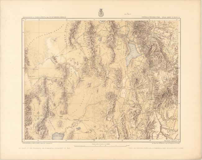
Subject: Utah

Period: 1874 (circa)

Publication: U.S. Geographical Surveys West of the 100th Meridian

Color: Printed Color

Size:
18.9 x 14.9 inches
48 x 37.8 cm
Download High Resolution Image
(or just click on image to launch the Zoom viewer)

This attractive and detailed map covers the region from just south of the Great Salt Lake to the northern shore of Sevier Lake, including portions of the Wasatch Range and Great Salt Lake desert. In addition to topography and drainage structure, the map shows important wagon roads, trails, railroads, springs, mines, mountain passes, and settlements. Notable features include Utah Lake, the Deseret Telegraph and W. V. Telegraph lines, and the spot where Captain Gunnison and his party were ambushed and killed in 1853, still fresh in the public's memory over 20 years later. Alta, then a mining town and now site to one of Utah's world class ski areas, is marked. This portion of the map also include lands now occupied by the Snowbird, Brighton, Deer Valley and Solitude ski areas as well as Sundance near Provo.

References:

Condition: A

A nice impression on a thick, clean sheet with a few spots of foxing confined to the blank margins.

Estimate: $150 - $180

Sold for: $110

Closed on 11/14/2018

Archived