Catalog Archive
Auction 170, Lot 307

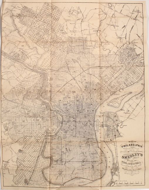
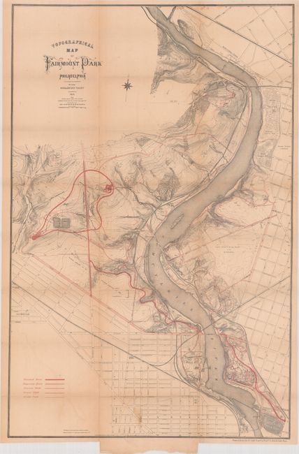
"[2 Folding Maps in] Handbook for the Use of the Members of the American Medical Association", Anon.

Subject: Pennsylvania, Philadelphia

Period: 1872 (published)

Publication:

Color: Printed Color

Size:
4 x 6.3 inches
10.2 x 16 cm
Download High Resolution Image
(or just click on image to launch the Zoom viewer)

This ephemeral handbook was given to members of the American Medical Association during their convention in Philadelphia in 1872. The 82 page handbook offers information on the numerous colleges, hospitals, and other attractions in the area and includes 12 pages of advertisements, 8 plates of local scenic views, and the following 2 folding maps:

Map of Philadelphia, a reduced version from Smedley's Complete Atlas of Philadelphia. This comprehensive map shows the street-grid pattern of the city, and extends west to Darby and east to Camden, New Jersey. Details include railroads, ferries, parks, and even individual buildings (14.7 x 19.5").

Topographical Map of Fairmount Park, Philadelphia. An attractive and detailed map of the park bordering the Schuylkill River with various patterns of red overprinting identifying drives, walks, and a bridle path (16 x 24").

Hardbound in maroon cloth with gilt title on the front cover.

References:

Condition: B

The map of Philadelphia is lightly toned with two short binding tears at bottom that just pass the neatline. The map of Fairmount Park, detached from the back cover, has light toning, faint offsetting, and a 5" tear at bottom that has been repaired on verso with archival tape. Text is lightly toned. Covers have light wear and the spine is sunned.

Estimate: $100 - $130

Sold for: $75

Closed on 11/14/2018

Archived