Catalog Archive
Auction 170, Lot 298

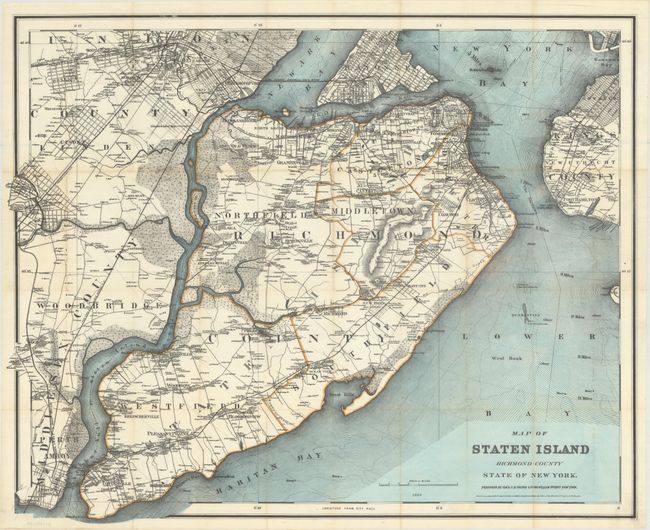
"Map of Staten Island Richmond County State of New York", Colton, G.W. & C.B.

Subject: Staten Island, New York

Period: 1889 (dated)

Publication:

Color: Hand Color

Size:
31.7 x 25.7 inches
80.5 x 65.3 cm
Download High Resolution Image
(or just click on image to launch the Zoom viewer)

This scarce pocket map centers on Staten Island and extends across Arthur Kill to include parts of Middlesex and Union counties. It also shows Bayonne, Gowanus, and New Utrecht and Fort Hamilton in Brooklyn. Roads and railroads are delineated, and there is nice topographical detail as well. Specific estates are identified by owner's name. Quarantine stations on Hoffman and Swinburne islands are located in the Lower Bay. Buoys and lighthouses are noted. Copyright dated 1884. The map is separated from its original red cloth boards (3.6 x 6.3"), which are included here.

References:

Condition: A

Issued folding with some tiny splits at fold intersections and a touch of toning along a few folds.

Estimate: $700 - $850

Unsold

Closed on 11/14/2018

Archived