Catalog Archive
Auction 170, Lot 284

"Sectional Map of Colfax and Mora Counties, New Mexico. Compiled from the Original Plats in the Surveyor General's Office at Santa Fe, New Mexico...",

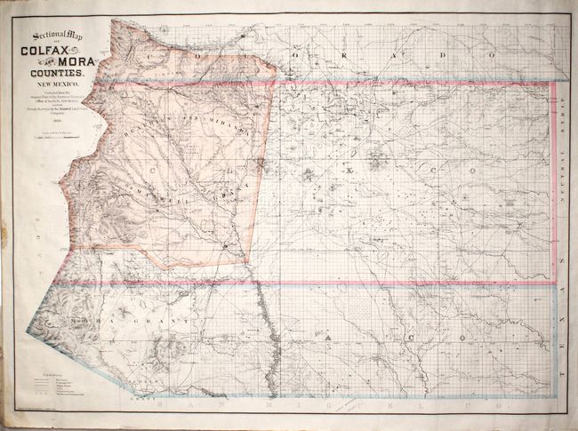
Subject: Northeastern New Mexico

Period: 1889 (dated)

Publication:

Color: Printed Color

Size:
37 x 26.5 inches
94 x 67.3 cm
Download High Resolution Image
(or just click on image to launch the Zoom viewer)

A detailed map of northeastern New Mexico most notable for the large Maxwell land grant in the western portion of Colfax County and far southern Colorado. A holdover from when the area was under Mexican control, the Maxwell Grant was over 1.7 million acres and one of the largest contiguous private landholdings in the United States. The map was issued during the time when the court system was determining the grant's validity, and in 1894 the Supreme Court ruled in favor of the company holding the grant. To the south of the Maxwell Grant are the smaller grants of Mora and Scolly. Beyond the land grants, the map is laid out in the familiar grid of townships with details including railroads, roads, trails, settlements, and more. Drawn by Edward Rollandet in Denver, Colorado.

References:

Condition: B+

A clean and colorful example with a 3.5" edge tear at left that has been closed on verso with archival tape. Remnants of cello tape are confined to the left blank margin.

Estimate: $200 - $250

Unsold

Closed on 11/14/2018

Archived