Catalog Archive
Auction 170, Lot 259

Vancouver's Large Chart of Hawaii

"Carte des Iles Sandwich d'Apres la Reconnoissance qui en a ete Faite dans les Differentes Relaches de la Corvelle la Decouverte et de sa Conserve le Chatham...", Vancouver, George (Capt)
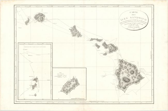
Subject: Hawaii

Period: 1799 (dated)

Publication: Voyage de Decouvertes a l' Ocean Pacifique…

Color: Black & White

Size:
30.2 x 21.6 inches
76.7 x 54.9 cm
Download High Resolution Image
(or just click on image to launch the Zoom viewer)

This rare, large-scale chart of the Hawaiian Islands shows Vancouver's numerous tracks throughout the region. It features good detail along the coastlines including soundings and anchorages, as well as excellent depictions of the rugged inland topography. At lower left are insets of the Gallapagos and Cocos islands.

During the period 1792-94, George Vancouver and the crew of the British naval ships Discovery and Chatham mapped the northwest coast of North America from Baja California to Alaska. Vancouver's voyage was the last, and longest, of the great Pacific voyages of the late eighteenth century. Taking the art and technique of distant voyaging to a new level, Vancouver eliminated the possibility of a Northwest Passage and his remarkably precise surveys completed the outline of the Pacific. His expedition was also partially responsible for the British domination of Australia and New Zealand and the establishment of the Kingdom of Hawaii through his assistance to Kamehameha I, the king of Hawaii.

References: Phillips (Atlases) #1219-2; Fitzpatrick (Early Mapping of Hawaii) plt. #21.

Condition: A

A dark impression on a bright sheet with a few faint dampstains almost entirely confined to the blank margins.

Estimate: $1,400 - $1,700

Sold for: $700

Closed on 11/14/2018

Archived