Catalog Archive
Auction 170, Lot 249

"A Map of the Seat of War in Florida ", U.S. Government
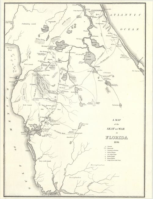
Subject: Florida

Period: 1836 (dated)

Publication:

Color: Black & White

Size:
10.8 x 14.9 inches
27.4 x 37.8 cm
Download High Resolution Image
(or just click on image to launch the Zoom viewer)

This is the first map by Major Gen. W. Scott to show the progress of the Seminole Wars. The map shows much of northern Florida from Charlotte Harbor in the southwest to St. Augustine in the northeast. Locates Tampa Bay, Lake George, Drums Lake, and numerous forts including Drane, Izard, Cooper, Alabama, and Brooke. Delineates the routes of Gen. Eustis, Col. Goodwin, plus the Military Road from Fort Brooke to Fort King. Locates swamps, fords, numerous small settlements, and a few battle sites. Many interesting place names like Negro Town, located northeast of Fort Cooper on the edge of the Great Swamp or the Cove of the Ouithlacoochee.

References: Claussen & Friis #152.

Condition: B+

A clean and bright example, issued folding with a 1.5" binding tear at left, a couple of short fold separations, and a 1/4" edge tear at top, all of which have been professionally repaired on verso with archival materials. The binding trim at bottom left has been remargined with old paper, with a section of the neatline replaced in facsimile.

Estimate: $130 - $160

Sold for: $95

Closed on 11/14/2018

Archived