Catalog Archive
Auction 170, Lot 231
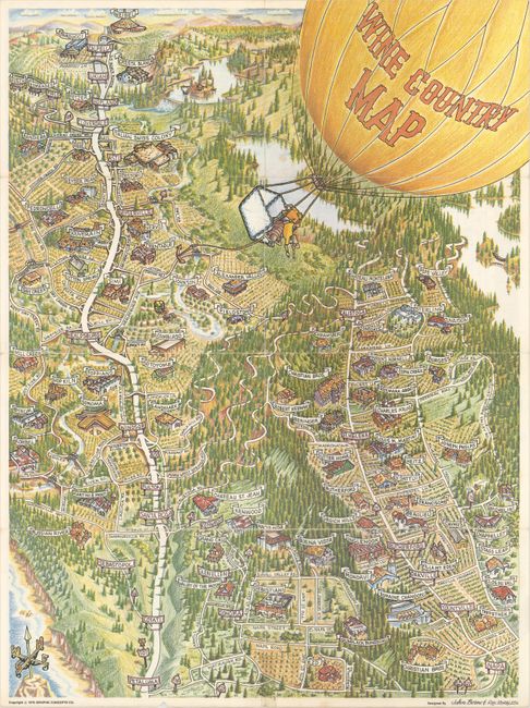
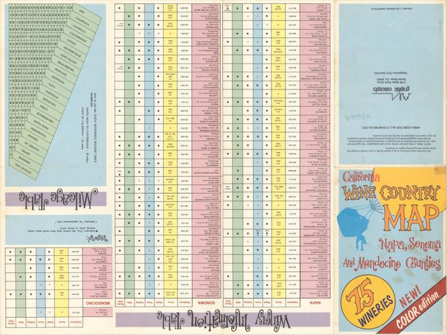
"Wine Country Map",

Subject: Northern California

Period: 1979 (dated)

Publication:

Color: Printed Color

Size:
16.8 x 22.4 inches
42.7 x 56.9 cm
Download High Resolution Image
(or just click on image to launch the Zoom viewer)

This colorful pictorial map depicts a bird's-eye view (or, more precisely, a view from a hot air balloon) of California's famous Wine Country. It was designed by John Born and Ron Morales and issued as a pamphlet by Graphic Concepts Co., based in Santa Rosa (pictured on the map). The map spans from Petaluma east to Napa and reaches north into Mendocino County. Among the notable towns and cities identified are Sonoma, Sebastopol, Kenwood, Yountville, Rutherford, Hopland, and Ukiah. It features a hot air balloon title cartouche with eager sightseers hanging over the edge of the basket. A table on verso provides information on 75 wineries.

References:

Condition: B+

Issued folding with a few short fold separations, one of which has been closed with cello tape at bottom.

Estimate: $150 - $180

Sold for: $180

Closed on 11/14/2018

Archived