Catalog Archive
Auction 170, Lot 225

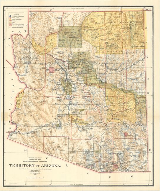
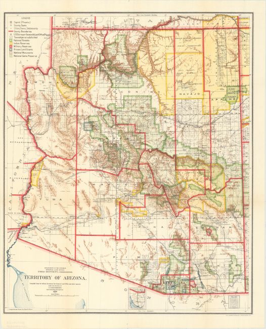
"[Lot of 2] Territory of Arizona", General Land Office

Subject: Arizona

Period: 1901-09 (dated)

Publication:

Color: Printed Color

Size:
16.9 x 20.2 inches
42.9 x 51.3 cm
Download High Resolution Image
(or just click on image to launch the Zoom viewer)

A. Territory of Arizona, dated 1901. A colorful and fascinating map with great detail issued eleven years before statehood. The extent of nine Indian reservations and at least three Military reservations, including Camp Apache, are clearly shown in different colors. Numerous confirmed and unconfirmed land claims are named and located. A huge Grand Canyon Forest Reserve is shown. The brown hachured mountain area and the blue waterways combine to provide great visual impact. Information includes watershed, mountains, railroads, wagon roads, private claims, unsurveyed townships, etc. A beautiful example published while Harry King was the Chief of Drafting and the Hon. Binger Hermann was commissioner. Condition: Very good example with a short tear just touching neatline at left that has been closed on verso with cello tape. (B+)

B. Territory of Arizona, dated 1909. An updated map from above, three years before statehood. The map details the extent of National Forest (not Forest Reserves as on previous editions), Indian Reservations, Military Reservations, and Private Land Grants. Also includes the new categories of National Monuments and National Game Preserves. Good detail of the large number of railroads of the day. The large extent of the Grand Canyon Forest Reserve and National Park is delineated. The use of brilliant colors gives this map a vibrant visual impact. Condition: Issued folding with a couple very small splits at fold intersections. (A)

References:

Condition:

See description above.

Estimate: $160 - $190

Sold for: $120

Closed on 11/14/2018

Archived