Catalog Archive
Auction 170, Lot 206

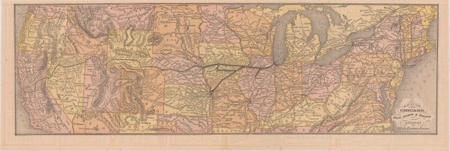
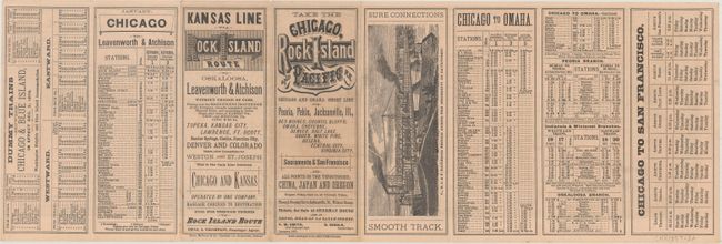
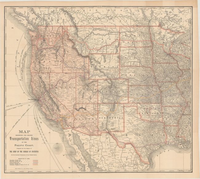
"[Lot of 2] Map of the Chicago, Rock Island & Pacific Railway and Connections [and] Map Exhibiting the Leading Transportation Lines of the Pacific Coast...", Rand McNally & Co.

Subject: Western United States, Railroads

Period: 1877-87 (dated)

Publication:

Color: Printed Color

Size:
See Description
Download High Resolution Image
(or just click on image to launch the Zoom viewer)

A. Map of the Chicago, Rock Island & Pacific Railway and Connections, dated 1877 (19.5 x 6.1"). This early Rand McNally map details the Chicago, Rock Island & Pacific Railroad. It covers the routes from Chicago to Leavenworth and Omaha with branches to Peoria, Indianola, and Winterset. The map continues west to San Francisco via the Union Pacific Railroad. The verso contains timetables and advertisements.

B. Map Exhibiting the Leading Transportation Lines of the Pacific Coast. Prepared for the Report of the Chief of the Bureau of Statistics on the Internal Commerce of the United States, dated 1887 (23.0 x 20.4"). Prepared for the Bureau of Statistics, this large folding map of the western United States details rail and sea routes. Attractively colored with the western states outlined in pink and the five major railroad systems shown in primary colors. Locates the routes of the Canadian Pacific, Northern Pacific, Union Pacific, Southern Pacific, and the Atchison, Topeka & Santa Fe railroads. Shows the shipping routes of clipper and steamer ships to/from San Francisco, Seattle, Portland and several other coastal cities.

References:

Condition: A

Nice examples, issued folding.

Estimate: $250 - $325

Unsold

Closed on 11/14/2018

Archived