Catalog Archive
Auction 170, Lot 199

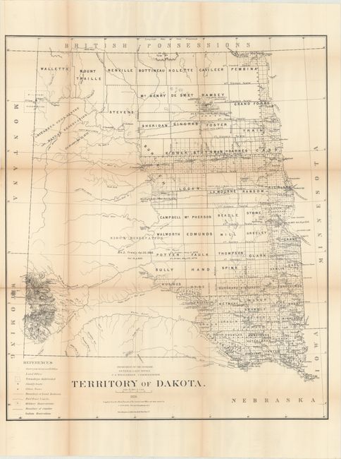
"Territory of Dakota", General Land Office
Subject: Dakota Territory

Period: 1876 (dated)

Publication:

Color: Black & White

Size:
24.5 x 29 inches
62.2 x 73.7 cm
Download High Resolution Image
(or just click on image to launch the Zoom viewer)

This large, uncommon survey map was compiled under the direction of Charles Roeser. It shows development that is confined to the region between the Missouri River and the Red River of the North. To the west of the Missouri River are the Sioux and Mandan Indian reservations, and a Military Reservation surrounding Fort Buford and Fort Union. The Northern Pacific Railroad is completed to Bismark with a projected path extending west, and the Black Hills are prominently shown in the southwest portion of the territory. The map also identifies county seats, land offices, railroad limits, and more.

The General Land Office produced this map as part of a series of maps of the states and territories to celebrate the Centennial. These maps were recognized as the most accurate and detailed maps of their time, and subsequently were widely used by commercial mapmakers.

References:

Condition: B+

Issued folding with light toning that is more prominent along the fold lines and several short splits at fold intersections. Two short edge tears at left have been closed on verso with archival tape.

Estimate: $160 - $200

Sold for: $50

Closed on 11/14/2018

Archived