Catalog Archive
Auction 170, Lot 176

"A Map of Virginia and Maryland", Salmon, Thomas

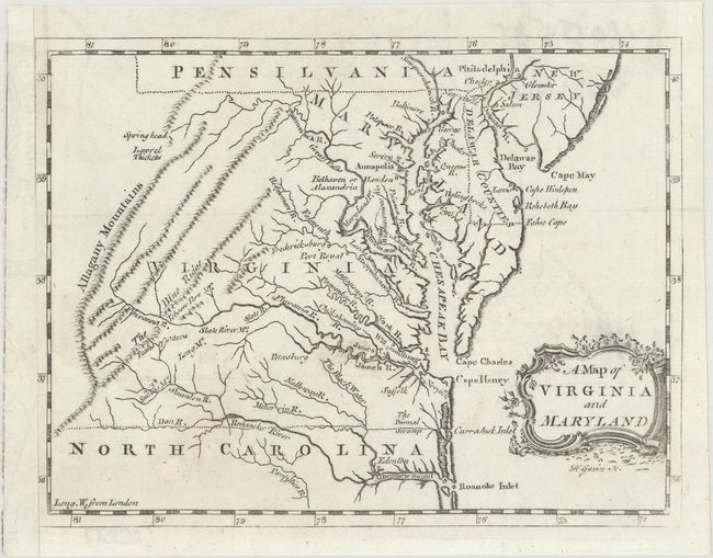
Subject: Colonial Mid-Atlantic United States

Period: 1767 (circa)

Publication: A New Geographical and Historical Grammar

Color: Black & White

Size:
7.6 x 5.8 inches
19.3 x 14.7 cm
Download High Resolution Image
(or just click on image to launch the Zoom viewer)

Of the dozens of editions of A New Geographical and Historical Grammar that were published, this map appeared only in the 1767 edition. The map focuses on the topography and towns in the region, and extends to show Delaware and parts of South Carolina, Pennsylvania and New Jersey. The dotted borders between the states are quite irregular, and appear to have been drawn freehand. The map appears to be a derivative of the Fry & Jefferson map of Virginia from 1753 based on the shape of the Delmarva Peninsula. Engraved by H. Gavin. An uncommon map.

References: Sellers & Van Ee #1391; McCorkle (18th C. Geog. Books) #364 [28].

Condition: A

A nice impression on a clean, bright sheet with an "IV" watermark and one tiny hole at lower left that has been professionally repaired. Remargined at left with period-correct paper, with minor loss of neatline. Issued folding.

Estimate: $350 - $450

Sold for: $325

Closed on 11/14/2018

Archived