Catalog Archive
Auction 170, Lot 148

"Pictorial Map of the United States", Thayer & Co.

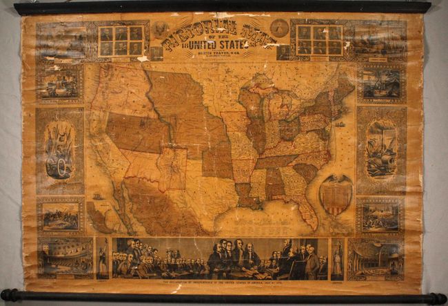
Subject: United States

Period: 1853 (dated)

Publication:

Color: Hand Color

Size:
40 x 28.9 inches
101.6 x 73.4 cm
Download High Resolution Image
(or just click on image to launch the Zoom viewer)

A terrific wall map published at a time when many territorial borders were at their most unique configurations. Utah is a large territory that includes all of Nevada and most of Colorado, and New Mexico extends between Texas and California. In California, the Gold Region is prominently depicted. Oregon Territory extends to the Continental Divide and encompasses present-day Washington. Nebraska extends from Indian Territory to the Canadian border and includes today's Montana, Wyoming, Kansas, and about half of the Dakotas. Minnesota Territory includes the eastern Dakotas, and Oklahoma is Indian Territory. There is an extensive railroad network throughout the East, with a number of emigrant routes shown in the western territories. Surrounding the map is a series of 15 vignettes including the signing of the Declaration of Independence, the Landing of Columbus, and the Battle of Monterey. Linen backed with original rollers.

References:

Condition: C+

Overall moderate toning due to the varnish with some cracking in the image and several small areas of image loss in the surrounding vignettes and around the title. Rollers are present and intact.

Estimate: $600 - $750

Sold for: $500

Closed on 11/14/2018

Archived