Catalog Archive
Auction 169, Lot 794

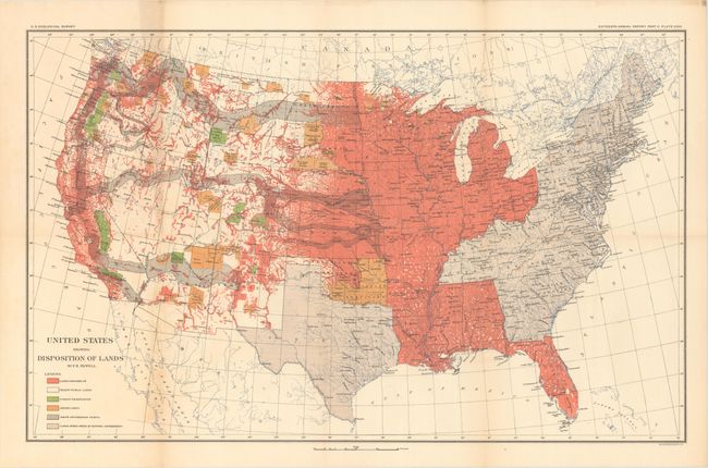
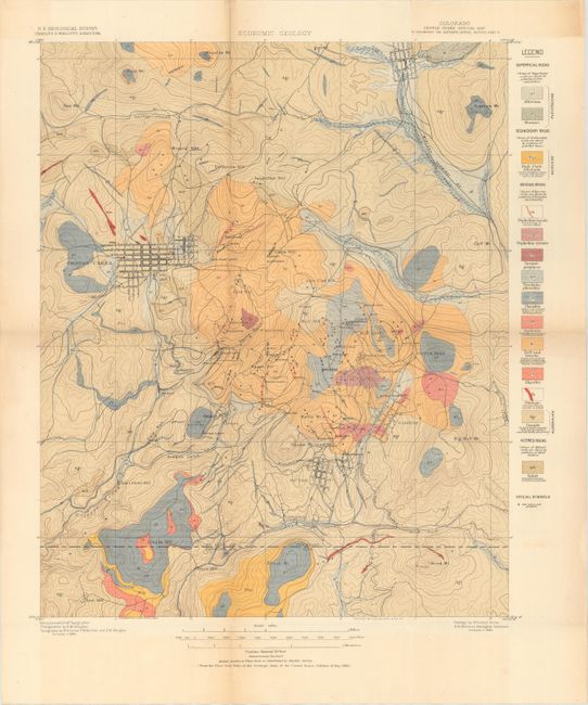
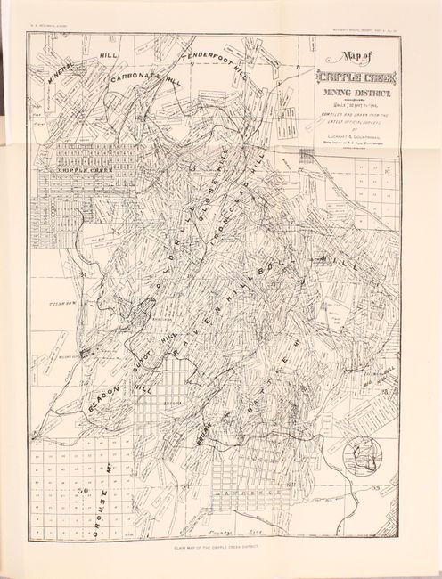
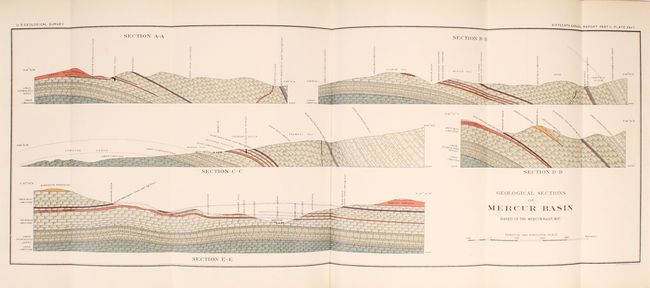
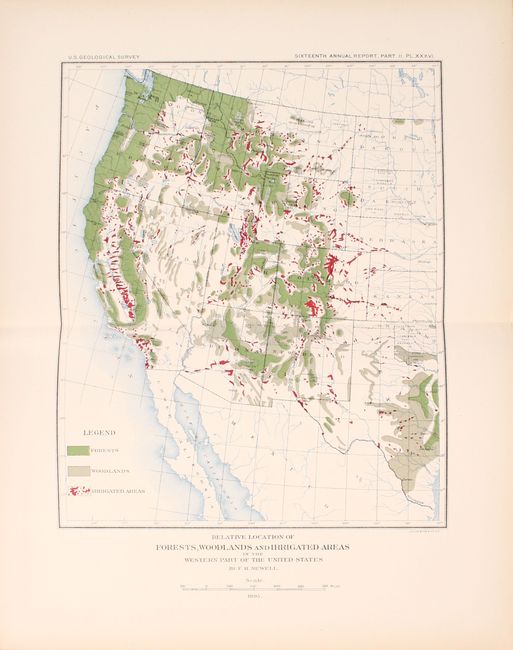
"[Sixteenth Annual Report of the U.S. Geological Survey, Part II]", U.S. Geological Survey (USGS)

Subject: Exploration & Surveys, Geology

Period: 1895 (published)

Publication:

Color: Printed Color

Size:
7.9 x 11.6 inches
20.1 x 29.5 cm
Download High Resolution Image
(or just click on image to launch the Zoom viewer)

Part II of the Sixteenth Annual Report of the U.S. Geological Survey concerns economic geology and was published under the direction of Charles Walcott . This volume contains Cross and Penrose's "Geology and Mining Industries of the Cripple Creek District, Colorado" and S.F. Emmons report on "Economic Geology of the Mercur Mining District, Utah" among others. The complete volume contains 40 plates, 65 in-text illustrations, and the following two folding maps housed in a rear pocket:

Colorado Cripple Creek Special Map (16.1 x 19.6"). This striking topographic map shows the mining town (and former ghost town) Cripple Creek and its surroundings in what is today Teller County. Several mountains, gulches, and hills are named, and a few towns appear in grid-like plans, including Victor and Cripple Creek itself. A legend to the right of the map explains the corresponding rock type for each color and pattern combination on the map. The map is also freckled with several small stars that represent various gold mines and prospects.

United States Showing Disposition of Lands (28.2 x 17.5"). This attractive map of the United States is color-coded to show the status of federal lands, including a large swath of disposed lands in the center of the country and along the west coast. Other types include vacant public lands, forest reservations, Indian lands, railroad grants, and land not owned by the federal government (former colonies and Texas). Compiled by Frederick Haynes Newell, who would later become the first director of the United States Bureau of Reclamation in 1902.

598 pages. Quarto, hardbound in brown cloth with gilt title on spine.

References:

Condition: B+

Maps, plates, and text are very good with a hint of pleasant light toning. There is a library stamp on the title page and a library bookplate on the front pastedown. Covers have only light wear with bumped edges. An attractive example.

Estimate: $275 - $350

Sold for: $200

Closed on 9/12/2018

Archived