Catalog Archive
Auction 169, Lot 746

"Carte du Congo et du Pays des Cafres", Delisle, Guillaume

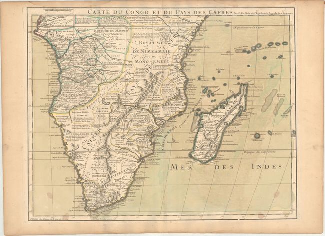
Subject: Southern Africa, Madagascar

Period: 1708 (dated)

Publication:

Color: Hand Color

Size:
24.4 x 19.2 inches
62 x 48.8 cm
Download High Resolution Image
(or just click on image to launch the Zoom viewer)

This is Delisle's meticulously detailed map of Southern Africa. It is emblematic of all Delisle's works, distinguished by his scientific approach to cartography. His work was the basis of most African maps made in the 18th century. The map covers Africa south of the Equator and includes Madagascar and several islands in the Indian Ocean. It is filled with information concerning European trade, native kingdoms and mineral wealth.

References:

Condition: B+

A nice impression on watermarked paper with original wash and outline color. There are several stains in the bottom corners, light offsetting, and light toning along the edges of the sheet.

Estimate: $200 - $230

Sold for: $150

Closed on 9/12/2018

Archived