Catalog Archive
Auction 169, Lot 717

"A New and Correct Map of Africa. Drawn from the Most Approved Modern Maps and Charts, and Adjusted by Astronomical Observations...", Bowen, Emanuel
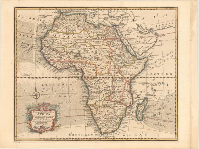
Subject: Africa

Period: 1748 (dated)

Publication: Harris' Collection of Voyages

Color: Hand Color

Size:
17.6 x 14.4 inches
44.7 x 36.6 cm
Download High Resolution Image
(or just click on image to launch the Zoom viewer)

Finely engraved map of the continent that is notable for its indications of the various wind directions that were so important to early explorers. In South Africa the settlements of Hellenbok and Drakenstein are located along with a Dutch fort and a river that is said to have no end. The Hottentot tribes are shown north of these settlements, and gold and silver mines are depicted in Zimbabwe. The Nile arises from Lake Dambea. There are several notations in the interior referring to the legendary Antropophages or Man Eaters. Embellished with a nice title cartouche and compass rose.

References: Norwich #89.

Condition: A

Attractive color on a clean sheet. There are some binding holes in the far right blank margin that have been reinforced with non-archival tape on verso that do not impact the image.

Estimate: $350 - $425

Sold for: $250

Closed on 9/12/2018

Archived