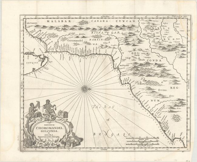
"Regionum Choromandel, Golconda, et Orixa. Nova et Accurata Descriptio",
Subject: Eastern India
Period: 1672 (published)
Publication: Naauwkeurige Beschryvinge van Malabar en Choromandel…
Color: Black & White
Size:
14.3 x 11.4 inches
36.3 x 29 cm
This uncommon map was created by Philip Baldaeus, a Dutch missionary in the Malabar and Coromandel districts. His work, Naauwkeurige Beschryvinge van Malabar en Choromandel…, is considered one of the foremost sources regarding Dutch settlements in southern India. This map depicts the eastern coast of India from the Palk Strait to Baleshwar, with north oriented to the right. Numerous towns and place names line the coast, with soundings and anchorages noted along the shore. In the interior are rivers, mountains, a few place names, and depictions of animals, including pairs of elephants and leopards. The map extends to include the northern tip of Sri Lanka, with several place names and soundings noted. The strapwork title cartouche features two Indian boys with several treasure chests and oysters with pearls.
References: Shirley (BL Atlases) G.BALD-1a #12.
Condition: B+
A dark impression on a mostly clean sheet with some light offsetting and a minor dampstain that enters the image at top right. Issued folding.