Catalog Archive
Auction 169, Lot 66

"America", Bertius/Claesz

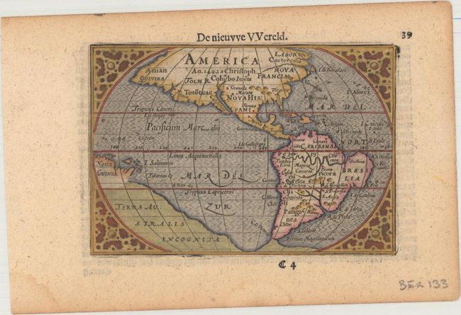
Subject: Western Hemisphere - America

Period: 1609 (published)

Publication: Hand-Boeck of Cort Begrijp der Caerten

Color: Hand Color

Size:
4.9 x 3.3 inches
12.4 x 8.4 cm
Download High Resolution Image
(or just click on image to launch the Zoom viewer)

This is a Dutch edition of this charming miniature map that was based on the 1587 folio map by Abraham Ortelius. A notation in North America notes its discovery by Christopher Columbus in 1492. Mythical locations such as Quivira, Norombega, Granada, and Marata are named in North America. The area north of Quivira is called Anian. While the whole of the present-day United States is misshapen, the Mid-Atlantic region, labeled Virginia, is especially protuberant. A massive continent named Terra Australis Incognita and a fragment of Nova Guinea appear with incomplete coastlines. This map has a convoluted publishing history and it has been attributed to both Cornelis Claesz and Petrus Bertius. It made its appearance in a number of works starting with Claesz' work criticizing the Spanish for their treatment of the Indians. It then appeared in Bertius' revision of Langenes' pocket atlas. Claesz was the publisher for both these works. An alternate title, De nieuvve VVereld, appears above the top border.

References: Burden #92; Van der Krogt (Vol. III) 9000:341.

Condition: A

A crisp impression with minor toning, a small damp stain at bottom left, and some minute worm holes confined to the blank margins.

Estimate: $375 - $450

Sold for: $275

Closed on 9/12/2018

Archived