Catalog Archive
Auction 169, Lot 641

"Turquie d'Asie, Arabie, Perse, Tartarie Independante", Robert de Vaugondy, Didier

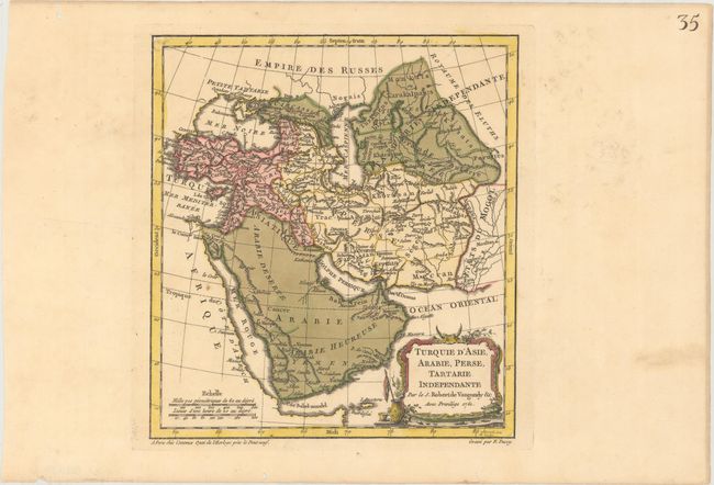
Subject: Middle East

Period: 1761 (dated)

Publication: Nouvel Atlas Portatif

Color: Hand Color

Size:
8.6 x 9.4 inches
21.8 x 23.9 cm
Download High Resolution Image
(or just click on image to launch the Zoom viewer)

Nicely engraved map with the Arabian Peninsula figuring prominently. The map shows all of Turkey and the Black Sea, and extends east to include the Caspian Sea and the region of today's Afghanistan, Pakistan, and Turkmenistan. The map was engraved by E. Dussy and the cartouche by Arrivet. This is the first state.

References: Pedley #380.

Condition: A

A crisp impression with original color in the map and later color in the cartouche on paper with a Strasbourg Lily watermark. There are several worm holes confined to the far blank margins.

Estimate: $80 - $95

Sold for: $60

Closed on 9/12/2018

Archived