Catalog Archive
Auction 169, Lot 635

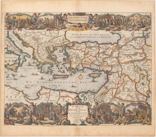
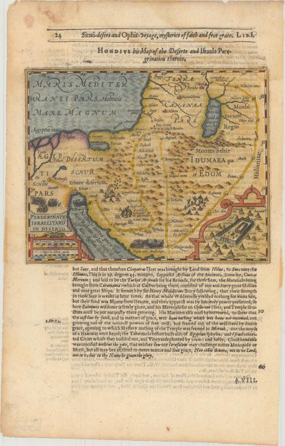
"[Lot of 2] De Beschryvingh van de Reysen Pauli, en van de Andere Apostelen... [and] Peregrinatio Israelitaru in Deserto",

Subject: Eastern Mediterranean & Middle East

Period: 1624-1729 (circa)

Publication:

Color: Hand Color

Size:
See Description
Download High Resolution Image
(or just click on image to launch the Zoom viewer)

A. De Beschryvingh van de Reysen Pauli, en van de Andere Apostelen..., by Bastiaan Stoopendaal, circa 1729 (17.9 x 13.8"). This beautiful map of the eastern Mediterranean region details the travels of Apostle Paul. It is richly decorated with scenes from St. Paul's travels in vignettes along the top and bottom, and numerous sailing ships and a compass rose in the sea. This is a later state with Stoopendaal's imprint replaced by that of Pieter and Jacob Keur. Dutch text on verso. Ref: Poortman & Augusteijn #135-GII3. Condition: There is light scattered foxing mostly confined to the blank margins, minor show-through of text on verso, and a light printer's crease to the right of the centerfold. A small chip in the bottom blank margin has been repaired with archival materials.

B. Peregrinatio Israelitaru in Deserto, by Hondius/Purchas, circa 1624 (7.4 x 5.8"). This handsome small map depicts the Exodus and the wandering of the Children of Israel. An inset of the Encampment of Israel is enclosed in a strapwork border. An alternate title runs above the map: Hondius His Map of the Deserts and Israels Peregrination Therein. On a sheet of English text measuring 8.4 x 13.3". At the beginning of the 17th century, Samuel Purchas, an English cleric, set out to publish a compendium of voyages to foreign countries. To illustrate his work, Purchase obtained the rights to use Jodocus Hondius' copperplates from Atlas Minor. Over 60 maps were included in Purchas His Pilgrimes, most of which were from Hondius' plates, with English titles inserted above them. Purchas also had a few additional maps engraved, including those for India, China, Greenland, North America, and Nova Scotia. Ref: Shirley (BL Atlases) G.PUR-1a #1. Condition: There is minor show-through of text on verso and a damp stain that just enters the top right corner of map image.

References:

Condition: B+

See description above.

Estimate: $400 - $475

Sold for: $300

Closed on 9/12/2018

Archived