Catalog Archive
Auction 169, Lot 618

"Nieuwe Paskaart vant Naauw van de Straat, op Gedragen aan den Hoog Edel: Geboren Heer F. van Aerssen van Sommelsdyk...", Leth, Andries & Hendrik de

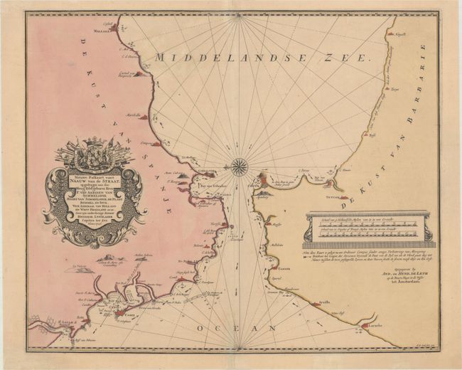
Subject: Strait of Gibraltar

Period: 1726 (dated)

Publication:

Color: Hand Color

Size:
21.6 x 17.9 inches
54.9 x 45.5 cm
Download High Resolution Image
(or just click on image to launch the Zoom viewer)

This is a scarce and superb nautical chart of the Strait of Gibraltar, with the coastlines of North Africa and Spain including the Bay of Cadiz. The coast of Spain extends from Rota to Malaga, while the coast of Morocco extends from to Larache to Netgalli (near El Hoceima). The chart provides good coastal detail with soundings, anchorages, the direction of current, and navigational hazards carefully noted. The map is beautifully decorated with elaborate title and and distance scale cartouches.

References:

Condition: A

A sharp impression with contemporary color on paper with a "WM" watermark. There are a couple of unobtrusive spots of foxing and a professionally repaired centerfold separation that enters 2" into image at bottom.

Estimate: $475 - $600

Unsold

Closed on 9/12/2018

Archived