Catalog Archive
Auction 169, Lot 553

"Novissima Russiae Vulgo Moscoviae Tabula", Allard, Carel

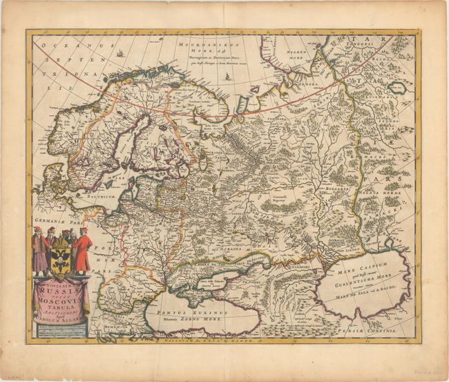
Subject: Russia, Scandinavia, Baltic

Period: 1698 (circa)

Publication:

Color: Hand Color

Size:
22.2 x 17.6 inches
56.4 x 44.7 cm
Download High Resolution Image
(or just click on image to launch the Zoom viewer)

This is Carel Allard's updated version of a similar map by his father Hugo, with a slightly different title and cartouche. It is based on the travels of Isaac Massa, the Dutch traveler and merchant, who first visited Russia during the Time of the Troubles. When he returned to Holland in 1609, he brought a rich collection of historical, geographical, ethnographic, and cartographic material that formed the basis of this and several other important maps of the region from this period. In addition to Russia, the map covers all of Scandinavia and the Baltic region through to include the Black and Caspian seas. It is nicely detailed including engraved forests and mountains. A couple ships are depicted sailing through the Norwegian Sea. The decorative title cartouche features Russian gentlemen surrounding the coat-of-arms of the Russian Federation.

References:

Condition: B+

A crisp engraving in original color with a centerfold separation at top that enters 0.5" into the map image and has been closed on verso with archival material. There is a printer's crease to the left of the centerfold and some short edge tears in the blank margins that have been archivally repaired on verso.

Estimate: $475 - $600

Sold for: $375

Closed on 9/12/2018

Archived