Catalog Archive
Auction 169, Lot 410

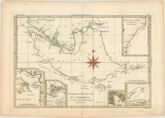
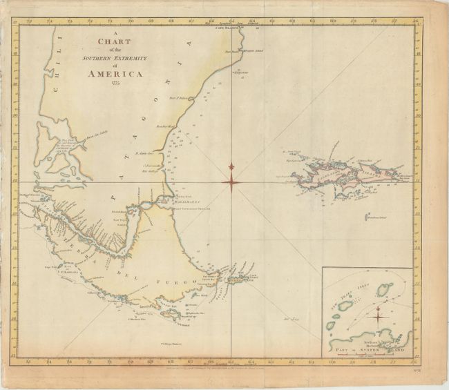
"[Lot of 2] Extremite Meridionale de l'Amerique [and] A Chart of the Southern Extremity of America 1775",

Subject: Southern South America

Period: 1777-87 (circa)

Publication:

Color: Hand Color

Size:
See Description
Download High Resolution Image
(or just click on image to launch the Zoom viewer)

Captain James Cook (1728-1779) is best known for his three voyages to the Pacific (1768-71; 1772-75; and 1776-79). His discoveries radically changed the western understanding of the world in the late 18th century. He was the first to circumnavigate and chart New Zealand and provided the earliest European accounts of exploration along the eastern coast of Australia and the Hawaiian Islands. On February 14th, 1779, he was killed on Hawaii after attempting to kidnap the chief of the island.

Many contemporary accounts of Cook’s voyages, including charts and engravings, appeared in the late 18th century. The first official account of Cook’s first voyage was published in 1773 by John Hawkesworth in Volumes II and III of An Account of the Voyages Undertaken by the Order of His Present Majesty for Making Discoveries in the Southern Hemisphere... William Strahan and Thomas Cadell published the first official accounts of the second and third voyages in 1777 and 1784. Accounts of his exploration were subsequently translated into French, German, and Dutch.

A. Extremite Meridionale de l'Amerique, by Rigobert Bonne, from Atlas Encyclopedique, circa 1787 (13.6 x 9.2"). This copper-engraved sheet of Tierra del Fuego is centered on a large compass rose. The map details the treacherous track through the Straits of Magellan. Five insets show bays, small groups of islands, soundings, rocks, and anchorages. Engraved by Andre. Condition: On a watermarked sheet with a short tear in the title cartouche that has been closed on verso with archival tape. There are short fold separations in the top and bottom blank margins that have also been archivally repaired on verso.

B. A Chart of the Southern Extremity of America 1775, by Cook/Strathan and Cadell, from A Voyage towards the South Pole, dated 1777 (19.9 x 16.9"). This interesting copper-engraved sea chart was published by William Strahan and Thomas Cadell. It traces the Resolution's track around Cape Horn in the winter of 1774-75. There is good detail along coastlines complete with soundings. It includes the Falkland Islands and an inset of "Part of Staten Land." Condition: Issued folding, now flat, with light soiling and toning along the sheet's edges that enter map image at bottom. There are several short edge tears in the margins, many of which have been repaired with archival materials on verso.

References:

Condition: B+

See description above.

Estimate: $160 - $190

Sold for: $90

Closed on 9/12/2018

Archived