Catalog Archive
Auction 169, Lot 316

"Mexico", Hall, Sidney

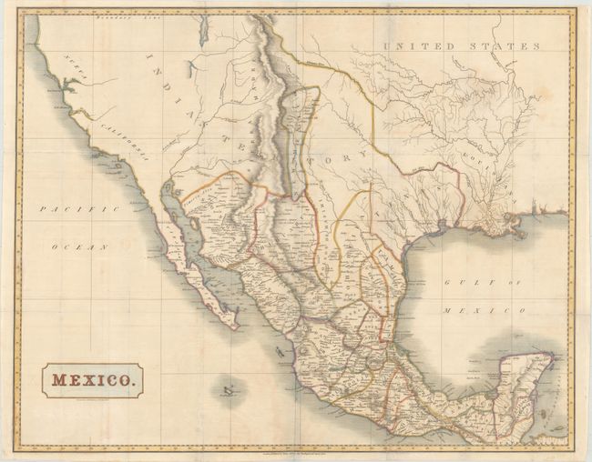
Subject: Southwestern United States & Mexico

Period: 1828 (dated)

Publication: Mexico in 1827...

Color: Hand Color

Size:
26.6 x 21.1 inches
67.6 x 53.6 cm
Download High Resolution Image
(or just click on image to launch the Zoom viewer)

This large, detailed map was published in Henry George Ward’s Mexico in 1827 and covers the region stretching from California to the Yucatan peninsula. It shows the political divisions of Mexico, which include Texas, New Mexico, and New California. A large section of the map is simply labeled "Indian Territory." Includes fine detail of settlements, mines, topography, and the river systems. In the west, California is almost completely void of detail with two rivers running from the Great Basin to the Pacific Ocean. Published by Henry Colburn in London.

References: Streeter #1104.

Condition: B+

Issued folding, now flattened, with several faint stains, light offsetting, and archival repairs to a number of fold separations and to a 2" tear in the state of Durango.

Estimate: $275 - $350

Sold for: $150

Closed on 9/12/2018

Archived