Catalog Archive
Auction 169, Lot 289
NO RESERVE
"Port of Providence Rhode Island from a Trigonometrical Survey Under the Direction of A.D. Bache Superintendent of the Survey of the Coast of the United States...", U.S. Coast & Geodetic Survey
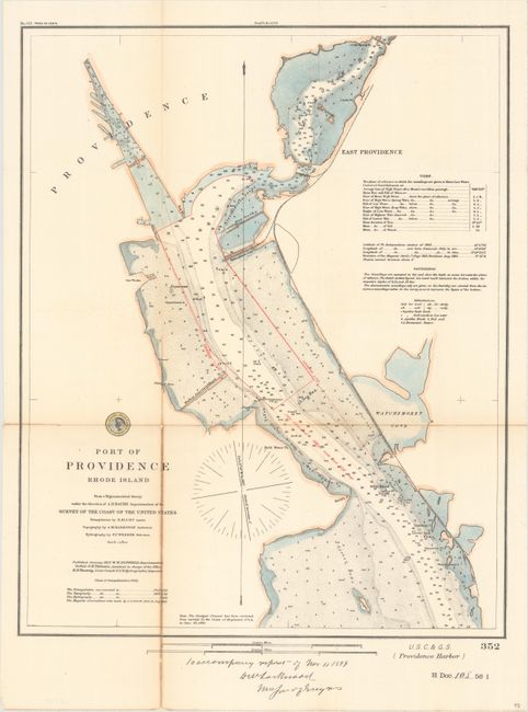
Subject: Providence, Rhode Island
Period: 1899 (dated)
Publication: H.R. Doc. 108, 56th Congress, 1st Session
Color: Hand Color
Size:
15.4 x 19.2 inches
39.1 x 48.8 cm
Download High Resolution Image
(or just click on image to launch the Zoom viewer)
(or just click on image to launch the Zoom viewer)