Catalog Archive
Auction 169, Lot 270

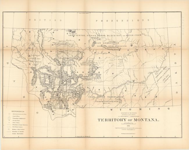
"Territory of Montana", General Land Office
Subject: Montana

Period: 1876 (dated)

Publication:

Color: Black & White

Size:
31.6 x 22.3 inches
80.3 x 56.6 cm
Download High Resolution Image
(or just click on image to launch the Zoom viewer)

This large map details the extent of public surveys in Montana at this important time in its territorial history. It was produced prior to the Custer disaster so that information is not presented. The map shows four large Indian reservations noting the date and the law establishing them. It locates many forts; Tullock, Sarpy, Union, Buford, Peck, Galpin, and many more including the old forts of Alexander and Charles. The Crow Indian Agency, Milk River Agency, Baker's Post are shown. The Northern Pacific Railroad and its Forty Mile Limit are delineated. At this time surveying is mostly limited to the west-central portion with the eastern half devoid of any activity. The legend identifies land offices, Surveyor Generals Office, county seats, towns, villages, railroad limits, military reservations, and Indian reservations. Drawn on a scale of 1 inch to 20 miles. Montana was admitted into the Union in 1889.

The General Land Office produced this map as part of a series of maps of the states and territories to celebrate the Centennial. These maps were recognized as the most accurate and detailed maps of their time, and subsequently were widely used by commercial mapmakers.

References:

Condition: B+

Issued folding with light toning along the fold lines. There are a number of small fold separations that have been partially closed on verso with archival tape.

Estimate: $180 - $220

Sold for: $60

Closed on 9/12/2018

Archived