Catalog Archive
Auction 169, Lot 259

"Plan de la Ville de Boston et ses Environs", Bellin, Jacques Nicolas

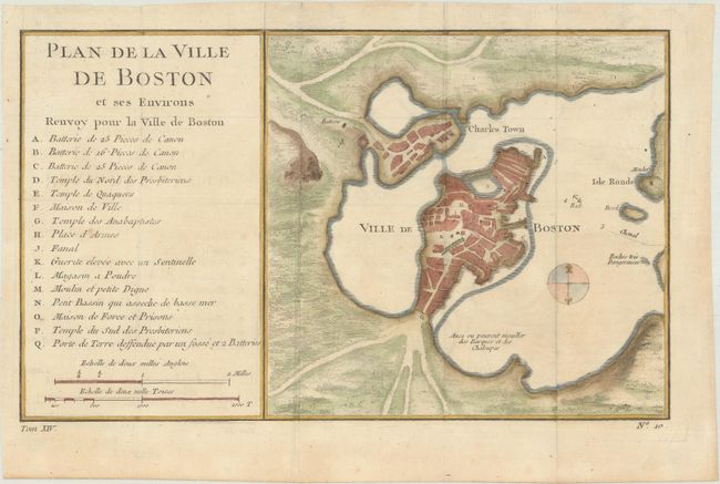
Subject: Boston, Massachusetts

Period: 1770 (circa)

Publication: Histoire Generale des Voyages

Color: Hand Color

Size:
10.8 x 6.4 inches
27.4 x 16.3 cm
Download High Resolution Image
(or just click on image to launch the Zoom viewer)

Attractive early plan of Boston and the harbor including Charles Town and Isle Ronde. It shows the street plan of the town and wharves, and locates gun batteries, powder magazines, Presbyterian churches, a prison, a town hall, a windmill, and a beacon. It indicates an offshore anchorage and the entrance channel and also depicts shoreline topography with the roads running down to the harbor. Large key at left lists sixteen important sites. Engraved at bottom neatline is Tom. XIV. This is very similar to the 1764 Bellin issue from the Petit Atlas Maritime, Tome I, No. 31, but the title and index are placed on the left.

References:

Condition: A

Issued folding on watermarked paper with minor toning along the edges of the sheet.

Estimate: $275 - $350

Sold for: $160

Closed on 9/12/2018

Archived