Catalog Archive
Auction 169, Lot 233

"Topographical Map of the Yosemite Valley and Vicinity", Wheeler, George (Lt)

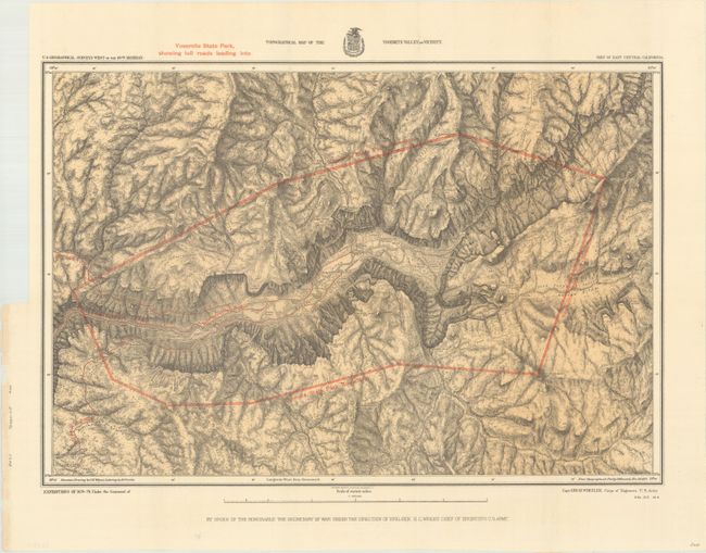
Subject: Yosemite, California

Period: 1883 (dated)

Publication: Sen. Ex. Doc. 22, 52nd Congress, 2nd Session

Color: Printed Color

Size:
21.2 x 14.5 inches
53.8 x 36.8 cm
Download High Resolution Image
(or just click on image to launch the Zoom viewer)

This fine map details the early development of the Yosemite valley after being designated a state park in 1864. The map is a product of Capt. G.M. Wheeler's Expeditions of 1878-79 with the U.S. Geographic Surveys West of the 100th Meridian, and depicts the state park boundaries and the toll roads leading to the park. Early camp facilities, trails, Indian settlements, and salient geographic features are also identified in considerable detail. The skillful rendering of the topography creates a remarkably strong graphic image of this picturesque valley. Mountain drawings by J.E. Weyss, with lettering by M. Franke, from the topographical plat by Lt. Macomb, Nov. 30, 1883.

References:

Condition: A+

A fine example, issued folding.

Estimate: $140 - $170

Sold for: $130

Closed on 9/12/2018

Archived