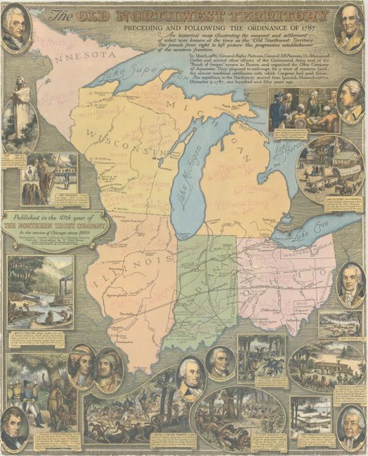
"The Old Northwest Territory Preceding and Following the Ordinance of 1787...",
Subject: Central United States
Period: 1936 (dated)
Publication:
Color: Printed Color
Size:
17 x 21 inches
43.2 x 53.3 cm
This fascinating map was issued at the 150th anniversary of the signing of the Northwest Ordinance of 1787 and published by The Northern Trust Company. The map covers Ohio, Indiana, Illinois, Michigan, Wisconsin, and the arrowhead of Minnesota and names numerous Indian tribes, forts, and settlements. The National Road and Michigan Road bisect the territory, and several early land grants are identified including the Seven Ranges, Ohio Company, Western Reserve, and Vincennes Tract. The map is surrounded by numerous portraits and vignettes of historical events that are keyed to the map. Blank verso.
References: Rumsey #8219.
Condition: B+
Trimmed to the border on all sides. Backed with tissue to repair a 2.5 x 5" chip at top right and several other minor tears.