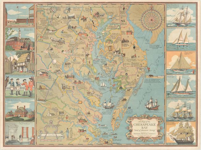
"A Map of the Chesapeake Bay "Land of Pleasant Living"",
Subject: Eastern Virginia, Maryland, Delaware
Period: 1959 (dated)
Publication:
Color: Printed Color
Size:
27.7 x 20.6 inches
70.4 x 52.3 cm
This pictorial map was drawn by Edwin Tunis and published by the National Brewing Company in Baltimore. It covers the region from Hagerstown south to Richmond and to points east including Maryland, Delaware, and the eastern shore of Virginia. The colorful map is filled with detailed illustrations and notations capturing the history and development in the region. A sampling of the illustrations include the site of Werowcomoco (Chief Powhatan's home), Mount Vernon, Oyster dredging, and wild ponies on Chincoteague. The map is flanked by vignettes at left and right including numerous sailboats/ships, important sites, and historical events. Further decorated by a compass rose, distance scale featuring dividers, and a strapwork title cartouche.
References:
Condition: B+
A colorful example with a 3" tear just above the Capitol and a 3" edge tear at bottom that have been archivally repaired on verso.