Catalog Archive
Auction 169, Lot 185

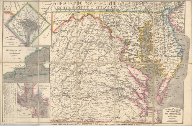
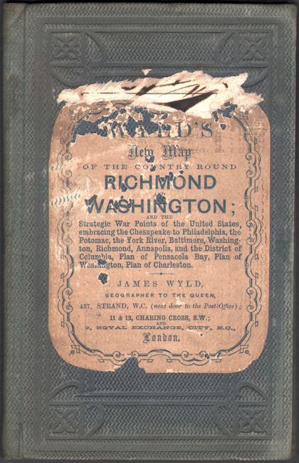
"Strategic War Points of the United States", Wyld, James

Subject: Mid-Atlantic United States, Civil War

Period: 1861 (circa)

Publication:

Color: Hand Color

Size:
20.2 x 13.3 inches
51.3 x 33.8 cm
Download High Resolution Image
(or just click on image to launch the Zoom viewer)

This separately issued map was published to keep the British updated on the theater of the American Civil War. The map covers the majority of Virginia, all of Maryland and Delaware, and the southern portions of New Jersey and Pennsylvania. Three insets maps at left depict Washington D.C., Pensacola Bay, and Charleston Harbor. Details include railroads, wagon roads, rivers, and settlements. Published by James Wyld at 457 Strand, 11 & 12 Charing Cross, and 2 Royal Exchange. Dissected and backed with linen and folds into green cloth boards with paper title on the front cover.

James Wyld was a prominent British publisher who specialized in producing maps that illustrated regions of the world and political events that were of particular interest to the British public. While Britain was officially neutral throughout the Civil War, there was a great amount of sympathy for the Confederate cause and a countervailing sentiment against slavery. This map was issued at a time when there was a great debate in Britain concerning recognition of the Confederacy.

References: Stephenson (CW) #18.7.

Condition: B+

Issued folding on a clean sheet and backed with original linen. Covers are moderately rubbed with some loss of paper title on front cover.

Estimate: $550 - $700

Sold for: $400

Closed on 9/12/2018

Archived