Catalog Archive
Auction 169, Lot 178

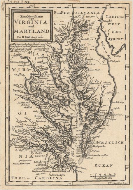
"Eine Neue Charte von Virginia und Maryland", Moll, Herman
Subject: Colonial Mid-Atlantic United States

Period: 1729 (circa)

Publication: Atlas Geographicus …

Color: Black & White

Size:
6.9 x 10 inches
17.5 x 25.4 cm
Download High Resolution Image
(or just click on image to launch the Zoom viewer)

This beautifully engraved map is centered on the Chesapeake Bay area. It is a German edition engraved by Johann Benjamin Bruhl after the popular and significant map published in the 1708 book, "British Empire in America" by Oldmixon. Highly detailed with political and physical information including early towns and village, bays, inlets and rivers. The map including place names is entirely in German. Engraved by Bruhl and published from Leipzig.

References: cf. Phillips (Maps) p. 980.

Condition: A

A nice dark impression, issued folding.

Estimate: $600 - $750

Sold for: $900

Closed on 9/12/2018

Archived