Catalog Archive
Auction 169, Lot 158

"A Map of Florida and ye Great Lakes of Canada", Morden, Robert

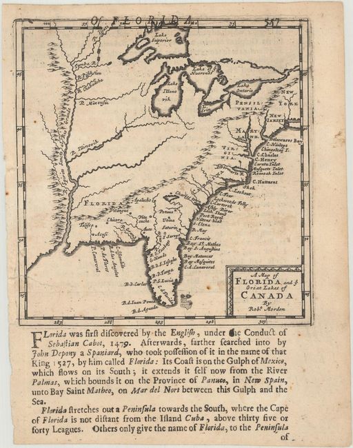
Subject: Colonial Eastern United States

Period: 1688 (circa)

Publication: Geography Rectified

Color: Black & White

Size:
4.9 x 5.1 inches
12.4 x 13 cm
Download High Resolution Image
(or just click on image to launch the Zoom viewer)

This uncommon little map shows all of the Atlantic seaboard from New York to Florida and westward to just beyond the Mississippi River. Despite the title, there is very little of Canada shown. The British colonies are named with numerous place names along the coast. Names the five Great Lakes, calling Lake Michigan Lake Illonovik. Features a prominent, entirely fictitious, mountain range located north-south along the Mississippi River. Another range stretches from the northeast, connecting with the Appalachians, and continuing into western Florida nearly to the Mississippi River. According to Cumming the map has little of Lederer's influence in the Virginia area with only one unnamed lake emptying into the Chesapeake. Below the map and continuing on the verso is English text containing a fascinating description of the area.

References: Cumming (SE) #109; Phillips (Maps) p. 565.

Condition: B+

There are a few spots of foxing and a couple of repaired edge tears at left, including one that extends 0.75" into the image.

Estimate: $600 - $750

Sold for: $450

Closed on 9/12/2018

Archived