Catalog Archive
Auction 169, Lot 144

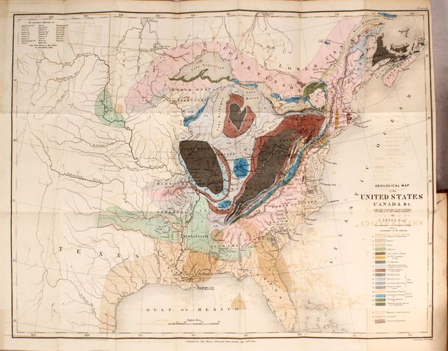
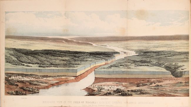
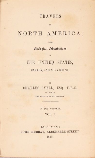
London Edition of Lyell's Important Account & Geological Map

"Geological Map of the United States Canada &c. [bound in] Travels in North America; with Geological Observations on the United States, Canada, and Nova Scotia", Lyell, Charles

Subject: Eastern United States & Canada

Period: 1845 (published)

Publication:

Color: Hand Color

Size:
4.9 x 7.9 inches
12.4 x 20.1 cm
Download High Resolution Image
(or just click on image to launch the Zoom viewer)

This is an important and early geological map by Sir Charles Lyell. Its color-coded key identifies 20 different geological units. The map extends to about the 110th meridian to include the Republic of Texas, Arkansas, Missouri, and the North West Territory. Lyell had two major and controversial goals in publishing his work and this map: first, he endeavored to establish a strict uniformitarian theory of the earth's geology, and also to standardize the terminology and methodology employed in the science of geology. This theory posits that the laws of nature are unwavering through space and time. His map, along with James Hall's work of 1843, is a landmark improvement in geological representations and mapping.

The map is accompanied by Lyell's important account of his travels in the region. Lyell, already an eminent naturalist and geologist when he arrived in America, journeyed up the Hudson River and across New York to Niagara Falls. From there he traveled through Pennsylvania, New Jersey, the Alleghenies, Carolinas, and into Kentucky and Ohio before completing his journey via the St. Lawrence River to Nova Scotia. His keen observations were as much social and political as they were geological, with discussion of education, economics, and racial issues. This is the London edition, which was published in the same year as the first American edition. Includes 6 additional plates (3 colored) with the attractive "Birds-Eye View of the Falls of Niagara & Adjacent Country" serving as the frontispiece to volume one. Volume 1 contains 316 pages, and volume 2 has 272 pages. 12mo, rebound in faux quarter leather over original leather boards with raised bands and gilt title labels on spines.

References: Marcou & Marcou #34; Howes #L575; Sabin #42761.

Condition: B+

The folding map has light to moderate offsetting and a 0.5" binding tear at right that has been archivally repaired on verso (B). Plates have light scattered foxing and text has occasional pleasant light toning. New spine is near fine and original boards have only minor shelf wear.

Estimate: $650 - $800

Sold for: $450

Closed on 9/12/2018

Archived