Catalog Archive
Auction 169, Lot 13

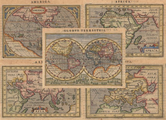
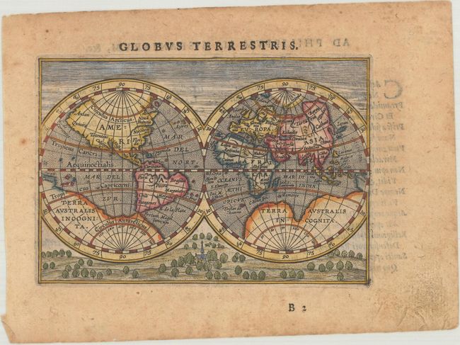
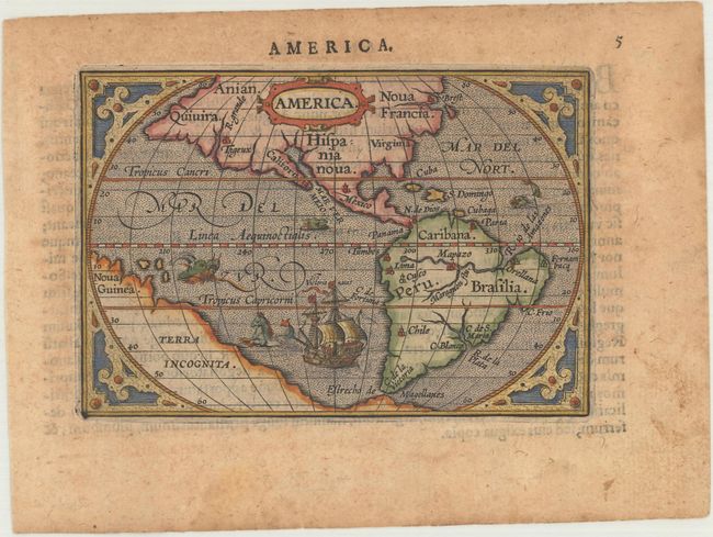
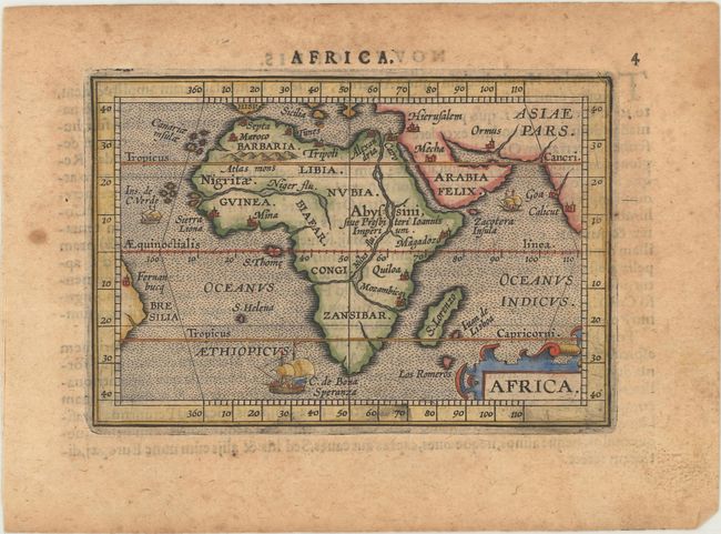
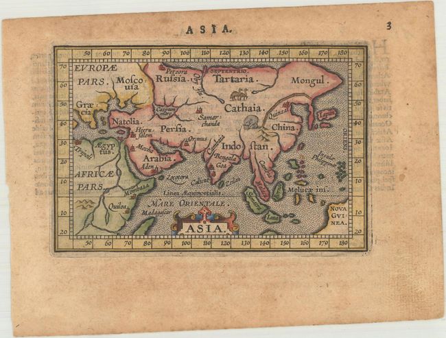
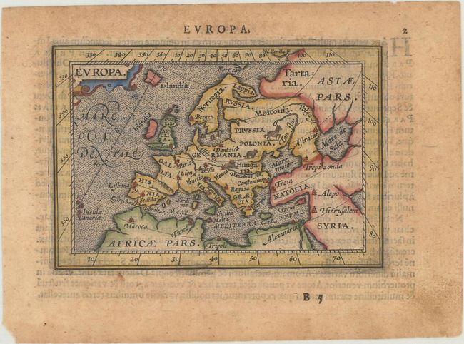
Matching Set from Miniature Ortelius Atlas

"[Lot of 5] Globus Terrestris [and] America [and] Africa [and] Asia [and] Europa", Ortelius/Coignet

Subject: World & Continents

Period: 1609 (published)

Publication: Epitome Theatri Orbis Terrarum

Color: Hand Color

Size:
4.9 x 3.3 inches
12.4 x 8.4 cm
Download High Resolution Image
(or just click on image to launch the Zoom viewer)

This matched set of maps featuring the world and continents was beautifully engraved by the brothers Ambrose and Ferdinand Arsenius, who had been assistants to Frans Hogenburg and co-engravers of Ortelius' folio Theatrum. This series of maps was accompanied by text by Michel Coignet and was published by Jan van Keerbergen. Latin text on verso. Size varies slightly.

A. Globus Terrestris. Captivating miniature double-hemisphere map with a landscape below the spheres centered on a church. The map shows a huge Terra Australis Incognita, and North America extends far north and west with the place names Quivira, California, Florida, and Totonteac. Reference: Shirley #231.

B. America. This map is lacking a great deal of detail but is interesting for a number of spurious rivers in North America, most notably two in Virginia, several feeding into the Gulf of California, and the R. Grande on the west coast near Quivera. The map is decorated with a large ship and several sea monsters and is surrounded in a strapwork border. Reference: Burden #143.

C. Africa. This handsome miniature map of Africa is lacking a great deal of detail but is interesting for its strange depiction of the Nile, which originates in a large lake south of the Equator. From this lake three large rivers flow to the seas: the Nile to the Mediterranean, the Congo to the Atlantic and what could be the Zambeze to the Indian Ocean. The map is decorated with a strapwork title cartouche and three sailing ships. Reference: Betz #47.

D. Asia. This charming little map includes depictions of an exotic elephant and camels in the interior of the continent. Korea is depicted as a long, thin peninsula and Japan bears a rectangular shape.

E. Europa. This miniature map of Europe is enclosed in a wide border marking the degrees of latitude and longitude and is beautifully engraved with stippled seas and tiny animals throughout the interior.

References: King (2nd ed.) pp. 86-87; Van der Krogt (Vol. III) #0001:332B, 1000:333, 8000:333, 8600:333, 9000:333.

Condition: B+

Nice impressions with light toning, minor foxing, and marginal soiling. The map of the Americas has a small, professionally repaired chip along the left edge of the sheet. The map of Asia has a short edge tear at right that has been archivally repaired.

Estimate: $1,800 - $2,200

Sold for: $1,200

Closed on 9/12/2018

Archived