Catalog Archive
Auction 169, Lot 133

The Northeastern Sheet of the Reduced-Size Edition of Popple's Map

"Nouvelle Carte Particuliere de l'Amerique ou sont Exactement Marquees la Nouvelle Bretagne, le Canada ou Nouvelle France, la Nouvelle Ecosse, la Nouvelle Angleterre, la Nouvelle York...", Popple/Covens & Mortier

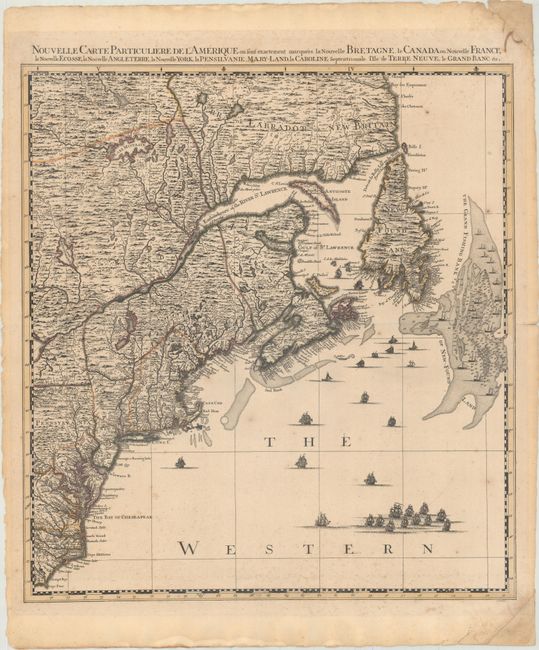
Subject: Colonial Northeastern United States & Canada

Period: 1741 (circa)

Publication:

Color: Hand Color

Size:
20.5 x 22.4 inches
52.1 x 56.9 cm
Download High Resolution Image
(or just click on image to launch the Zoom viewer)

This is the northeast sheet of Covens & Mortier's edition of A Map of the British Empire in America, Popple's monumental map of North America. Popple's map was the most important map to detail the country before John Mitchell's map of 1755. Popple based his map on firsthand information gathered over several years at the Board of Trade and Plantations. First issued in London on twenty sheets in 1733, it was the first large-scale British map to provide an overall view of the eastern half of North America. As tensions grew between the colonial powers, the map became immensely influential throughout Europe and was copied by several cartographers.

This sheet covers the region from Labrador to Cape Fear, North Carolina, and inland to the eastern shore of Lake Ontario. It is filled with incredible detail including the important Grand Fishing Bank of New-Foundland. The sea is filled with a myriad of different ships and fishing boats. The map stands on its own with complete borders with title above top border. Engraved by I. Condet.

References: cf. Kershaw #338; McCorkle #741.4.

Condition: B+

A dark impression in original outline color with light scattered foxing and a short centerfold separation confined to the right blank margin. The top and bottom corners of the sheet at right have been reinforced with old paper.

Estimate: $2,400 - $3,000

Unsold

Closed on 9/12/2018

Archived