Catalog Archive
Auction 169, Lot 114

"Carte de la Partie de la Cote Nord-Ouest de l'Amerique Reconnue Pendant les Etes de 1792, 1793, et 1794...", Vancouver, George (Capt)

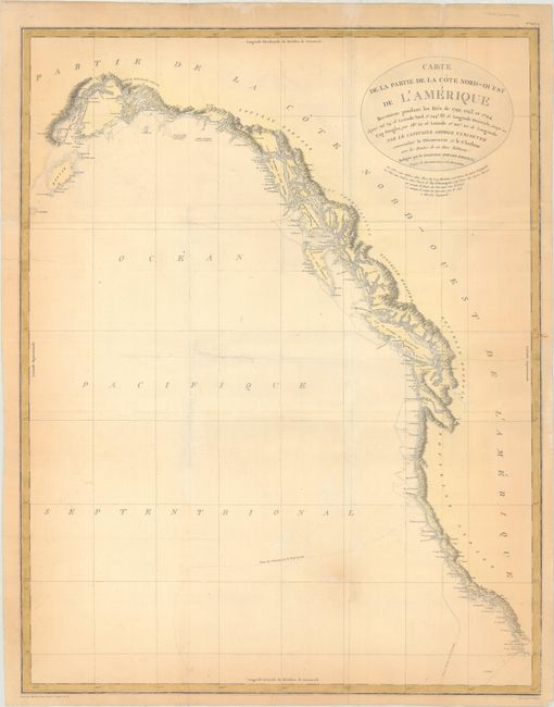
Subject: Western North America

Period: 1799 (published)

Publication: Vancouver's Voyages (French Edition)

Color: Hand Color

Size:
22.9 x 29.1 inches
58.2 x 73.9 cm
Download High Resolution Image
(or just click on image to launch the Zoom viewer)

This remarkably detailed chart covers the entire scope of Vancouver's expeditions of 1792-94. These expeditions finally closed the door on the idea of a Northwest Passage and at the same time opened the region to commerce and the fur trade. His charts of the lower Columbia River were used by Lewis and Clark on their monumental explorations. The chart includes the entire west coast from below San Diego north to Cook Inlet and Kodiak Island in Alaska. The finely engraved chart shows surprisingly good detail along the coast as it locates Port St. Francisco, Monterey Bay, C. Mendocino, C. Fairweather and more. Good detail up the Columbia River to Pte. Vancouver. Dotted lines delineate the tracks of his ships. Drawn by Lieutenant Edward Roberts and engraved by Blondeau. A historical and desirable chart that is seldom offered in this larger edition.

References: Falk #1799-3.

Condition: B

Issued folding, now flat, on watermarked paper with several tears that have been repaired on verso with archival materials. There is light to moderate toning along the map border.

Estimate: $300 - $375

Sold for: $220

Closed on 9/12/2018

Archived