"Map of North America",
Subject: North America
Period: 1833 (dated)
Publication: Three Years in North America
Color: Black & White
Size:
17.8 x 15.6 inches
45.2 x 39.6 cm
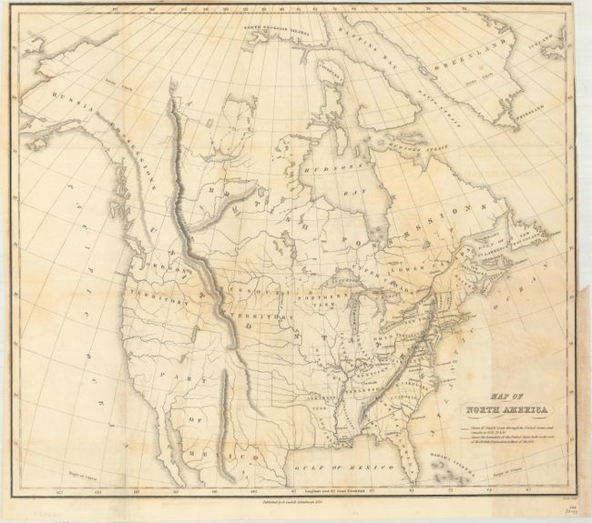
This map served as the frontispiece to James Stuart's Three Years in North America, and shows his route from New York to Savannah and along the western frontier before returning to the northeast. His journal (not included) presented rich descriptions of the stops along his route, and his writing presented a very favorable view of the United States. Cartographically, Missouri and Arkansas Territory define the western frontier with the large Missouri and Oregon territories to their northwest. Despite being published in Edinburgh, the map shows the United States claims well into present-day British Columbia, perhaps illustrating his pro-American view. Mexico is firmly in control of the Southwest, and Texas is not named. Engraved by Daniel Lizars and published by Robert Cadell. Four editions were printed in 1833 alone, indicating that Stuart's work was well received by the public.
References: Howes #S-1099; Sabin #93170.
Condition: B
Issued folding with light toning and offsetting. The lower right side of the sheet has been backed with linen to reinforce and repair a short binding tear. Narrow right side margin.