Catalog Archive
Auction 168, Lot 85

"Carte Generale de l'Amerique Divisee en Ses Principaux Etats", Robert de Vaugondy/Delamarche

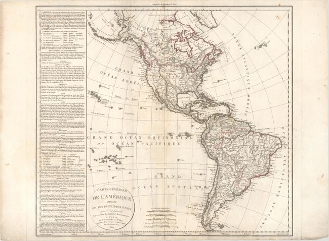
Subject: Western Hemisphere - America

Period: 1822 (dated)

Publication:

Color: Hand Color

Size:
23.7 x 21.3 inches
60.2 x 54.1 cm
Download High Resolution Image
(or just click on image to launch the Zoom viewer)

This is a scarce issue of Delamarche's map of North and South America that includes a column of text describing the physical features of the continents. In North America, Alaska (Amerique Russe) is shown in a rudimentary shape. In the Pacific Northwest, the United States juts into present-day Canada, but the coastal region down to the Columbia River is shown to be a part of British America - an interesting method of displaying the disputed region. There is a surprising level of topographical information presented in both continents.

References:

Condition: B+

Original outline color on watermarked paper with light scattered foxing and an extraneous crease to the left of the centerfold. There is a 2.5" centerfold separation at bottom that has been repaired on verso with archival tape, and a small paper flaw along the centerfold at top.

Estimate: $275 - $350

Unsold

Closed on 6/6/2018

Archived