Catalog Archive
Auction 168, Lot 725

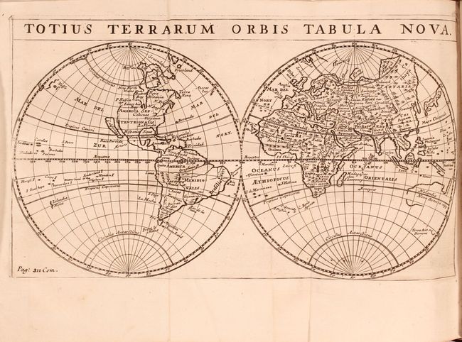
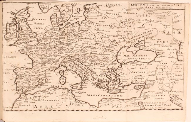
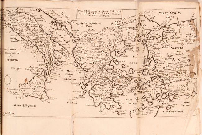
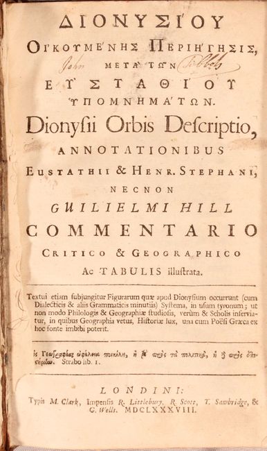
"Dionysii Orbis Descriptio, Annotationibus...",

Subject: Geography Books

Period: 1688 (published)

Publication:

Color: Black & White

Size:
4.9 x 7.8 inches
12.4 x 19.8 cm
Download High Resolution Image
(or just click on image to launch the Zoom viewer)

This geography book is written in both Latin and Greek and contains essays by Henri Estienne and William Hill. Included within the text are five maps related to both the modern and ancient world including:

Totius Terrarum Orbis Tabula Nova (10.0 x 5.6"). This double-hemisphere map of the world shows the Island of California with a flat northern coastline. The northwest part of the continent is virtually blank. In South America, the fictitious lakes of Parime and Xarayes are depicted. Australia shows only a partial coastline with both Tasmania and New Guinea appearing to be connected.

Terrae Universae Veteribus Cognitae Tabula Dionysio Accommodata (7.2 x 4.3").

Africae Veteribus Cognitae Tabula (9.9 x 6.1"). Condition: There are light dampstains confined to the lower blank margin.

Italiae, (Dempta Gallia Cisalpina) ac Graeciae, et Asiae Minoris Tabula Antiqua (11.1 x 5.9"). Condition: There is staining primarily along the right borer with two edge tears that just enter the image.

Europae, Fere Totius, cum Parte Asiae et Africae, Tabla Nova (11.5 x 6.7").

368 pages. 12mo, hardbound in full contemporary leather with raised bands on spine.

References:

Condition: B+

The maps are very good to near fine on bright sheets with only occasional minor imperfections. See description for more details. Text is mostly clean and tight with the front free endpaper is missing. Binding is very good with light wear and bumped edges.

Estimate: $400 - $475

Sold for: $300

Closed on 6/6/2018

Archived