Catalog Archive
Auction 168, Lot 705

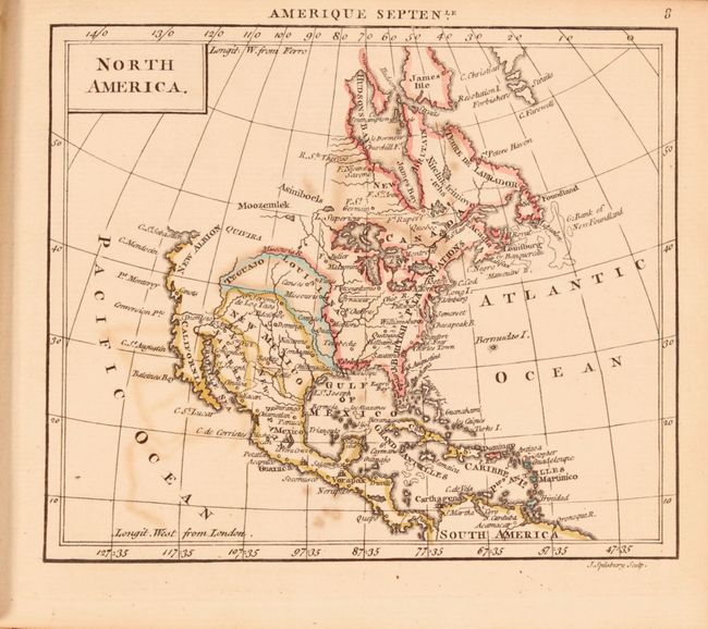
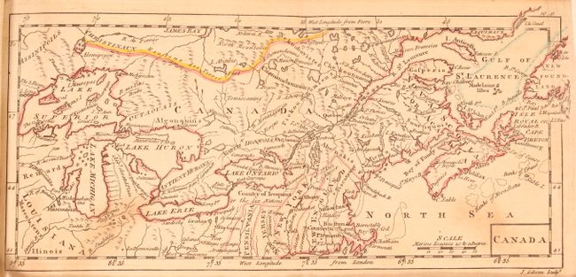
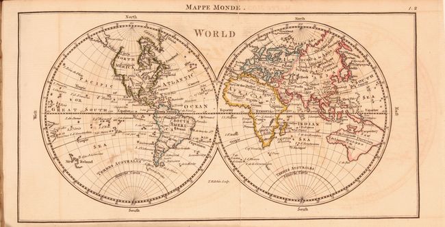
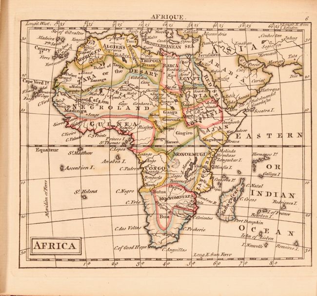
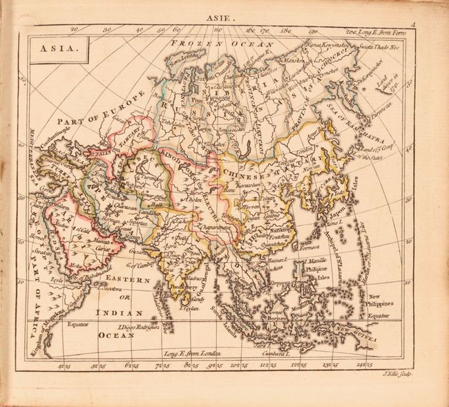
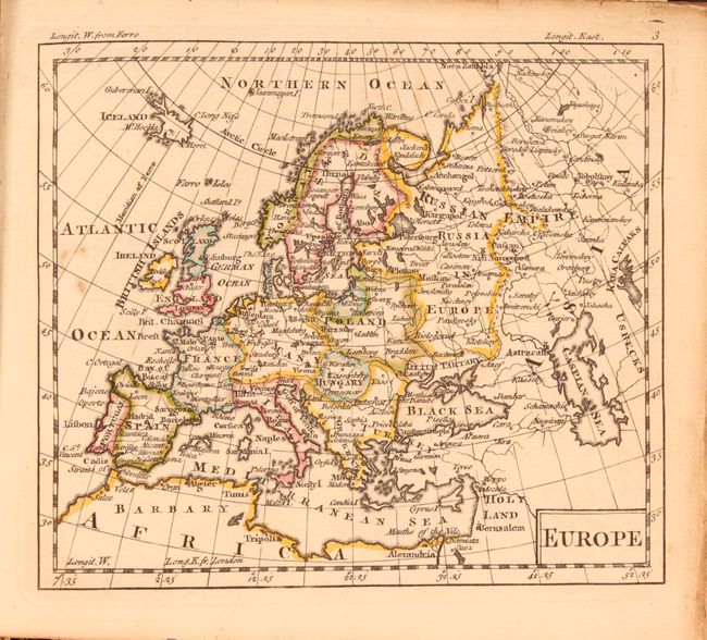
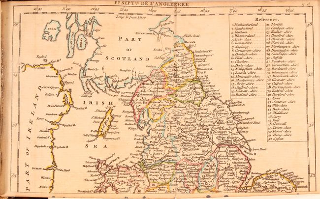
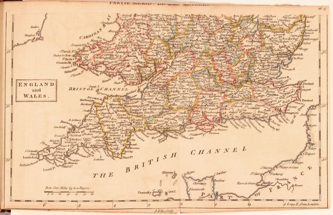
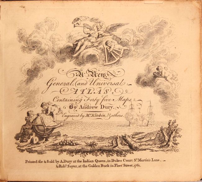
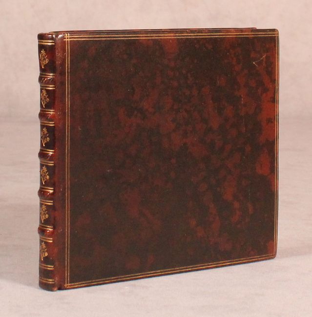
Uncommon Miniature Atlas with 39 Maps Updated Based on 1763 Treaty of Paris

"A New, General, and Universal Atlas. Containing Forty Five Maps", Dury, Andrew

Subject: Atlases

Period: 1763 (published)

Publication:

Color: Hand Color

Size:
6 x 5.1 inches
15.2 x 13 cm
Download High Resolution Image
(or just click on image to launch the Zoom viewer)

This uncommon miniature atlas features 39 maps by Thomas Kitchin, John Bayley, John Ellis, John Gibson and John Spilsbury. The maps include a double-hemisphere world, North America, South America, Canada, West Indies, Africa, western Africa, Asia, East Indies, Europe, and 29 maps related to European countries. Six of the maps are folding, double-page maps: world, Canada, northern England, southern England & Wales, northern France, and southern France. The first two editions of Dury's atlas are dated 1761 on the title page, however the second edition, published in 1763, depicts boundary changes based on the 1763 Treaty of Paris that ended the French and Indian War. This example, being the second edition, shows Britain in control of the eastern portion of North America up to the Mississippi River, as depicted on the maps of North America and Canada. The map of North America shows France confined to the middle part of the continent and several islands in the Caribbean. The map of Canada includes New England and the Great Lakes and depicts Pennsylvania, New Jersey, New York and New England as strips of land running north-south and separated from the Great Lakes by several Indian lands. On the world map, New Zealand is still only partially delineated, and New Holland is connected to New Guinea and Tasmania.

Oblong 24mo. Hardbound in mottled brown leather with 5 raised bands on spine and gilt tooling on covers and spine.

References: King (2nd Ed.) p. 174.

Condition:

The maps are in original outline color with light toning and occasional minor soiling and range in condition from very good (B+) to good (B). The original color has oxidized a bit, creating offsetting on adjacent maps. Several of the folding maps have short fold separations; however the world map has two long separations. There is a short tear on the title page at top left. The new covers are in excellent condition with a couple of minor scratches on the covers.

Estimate: $900 - $1,100

Sold for: $750

Closed on 6/6/2018

Archived