Catalog Archive
Auction 168, Lot 650

"A Map of the Continent of the East-Indies &c. Containing the Territories, Settlements, and Factories of the Europeans...", Moll, Herman

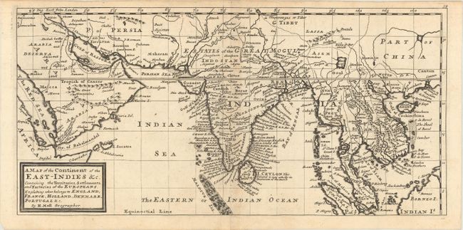
Subject: Southern & Southeast Asia

Period: 1729 (circa)

Publication: Atlas Minor

Color: Black & White

Size:
16.6 x 8.1 inches
42.2 x 20.6 cm
Download High Resolution Image
(or just click on image to launch the Zoom viewer)

This map covers the region from Arabia east to India, Indochina, China, and part of Borneo. It features many place names and is particularly detailed along the coast of India and Ceylon. South of the Kingdom of Lassa is the fictitious Chamay Lake, and the straits of Sincapora are located to the north of Sumatra. Decorated by Moll's simple block-style cartouche.

References: Shirley (BL Atlases) T.MOLL-9a #62.

Condition: B+

A sharp impression on watermarked paper with minor toning along the centerfold. Issued folding.

Estimate: $325 - $400

Sold for: $240

Closed on 6/6/2018

Archived