Catalog Archive
Auction 168, Lot 641

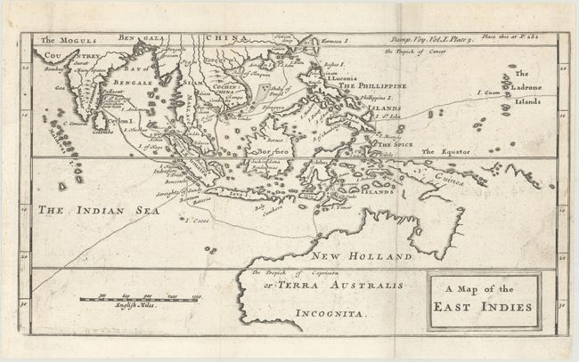
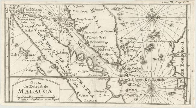
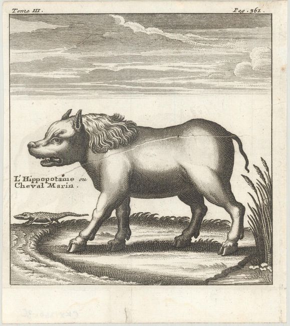
"[Lot of 3] A Map of the East Indies [and] Carte du Detroit de Malacca [and] L'Hippopotame ou Cheval Marin", Dampier, William (Capt.)

Subject: East Indies - Indonesia

Period: 1715-29 (circa)

Publication: A New Voyage Round the World

Color: Black & White

Size:
See Description
Download High Resolution Image
(or just click on image to launch the Zoom viewer)

William Dampier (baptized 1651-1715) was a buccaneer (pirate) and sea captain. He was the first Englishman to explore parts of New Holland and New Guinea, and was the first man to circumnavigate the world three times.
In the 1670s he crewed with buccaneers on the Spanish Main of Central America, which eventually led to his first circumnavigation. On the ship Cygnet, following Pacific-spanning raids that included the East Indies, Manila, and the Spice Islands, Dampier's ship was beached on the northwest coast of Australia in 1688. Waiting for repairs, his scientific interest surfaced as he made notes and drawings on the local fauna and flora. Following three years of further adventures he returned to England. In 1697 he published his experiences in A New Voyage. Described as one of the greatest tales of adventure and exploration ever written, the book was published in several languages. It is reported that Captain Cook used Dampier's nautical observations on his voyages, and Charles Darwin found his books so useful that he took them aboard the Beagle.

A. A Map of the East Indies, circa 1729 (11.1 x 6.1"). This uncommon chart shows the routes of Captain William Dampier's voyage throughout the region. Dotted lines delineates explorations from Guam, through the East Indies, the Philippines, Formosa (Taiwan), Indochina, the Gulf of Siam, and touching Northern Australia (Nouvelle Hollande). This was the first British scientific expedition to the region, gathering important data on the flora and fauna of Australia and New Guinea. From the 1729 English edition.

B. Carte du Detroit de Malacca, circa 1715 (10.9 x 5.9"). This map is roughly centered on the Straits of Malacca and Sincapore, including southern Malaysia and most of Sumatra to about Jambi. Identifies many place names including Malacca, Anchin (Aceh), Borneo, and more. Decorated by a compass rose capped by a fleur-de-lis and rhumb lines. From the 1715 French edition.

C. L'Hippopotame ou Cheval Marin, circa 1715 (5.3 x 5.4"). A crisp engraving of a rather menacing, but completely fictional, hippopotamus accompanied by a miniature, but equally fierce, crocodile. The hippo has the head of a wolf, the body of a bull, a lion's main, and pig ears. From the 1715 French edition.

References:

Condition: B+

Dark impressions on clean sheets of watermarked paper. The map of the East Indies has faint offsetting, and the hippopotamus plate has a printer's crease near the center of the image. Issued folding.

Estimate: $350 - $425

Sold for: $200

Closed on 6/6/2018

Archived